Sir John Monash, Personal Files Book 3, 11 April - 26 April 1915, Part 5
Copy of paper recd. 17/4/15
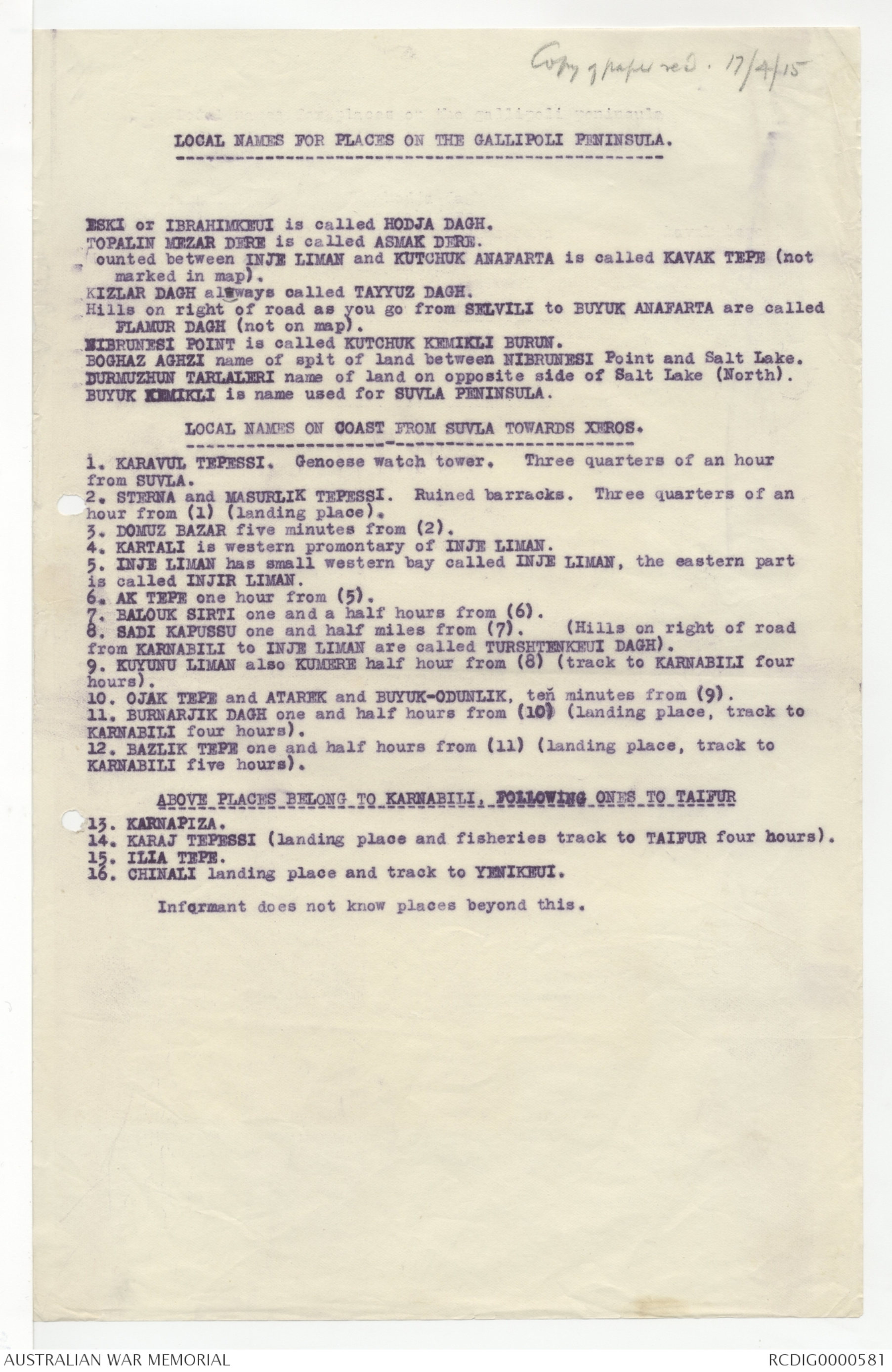
LOCAL NAMES FOR PLACES ON THE GALLIPOLI PENINSULA.
ESKI or IBRAHIMKEUI is called HODJA DAGH.
TOPALIN MEZAR DERE is called ASMAK DERE.
Mounted between INJE LIMAN and KUTCHUK ANAFARTA is called KAVAK TEPE (not
marked in map).
KIZLAR DAGH always called TAYYUZ DAGH.
Hills on right of road as you go for SELVILI to BUYUK ANAFARTA are called
FLAMUR DAGH (not on map).
NIBRUNESI POINT is called KUTCHUK KEMIKLI BURUN.
BOGHAZ AGHZI name of spit of land between NIBRUNESI Point and Salt Lake.
DURMUZHUN TARLALERI name of land on opposite side of Salt Lake (North).
BUYUK KEMIKLI is name used for SUVLA PENINSULA.
LOCAL NAMES ON COAST FROM SUVLA TOWARDS XEROS.
1.KARAVUL TEPESSI. Genoese watch tower. Three quarters of an hour
from SUVLA.
2. STERNA and MASURLIK TEPESSI. Ruined barracks. Three quarters of an
hour from (1) (landing place).
3. DOMUZ BAZAR five minutes from (2).
4. KARTALI is western promontary of INJE LIMAN.
5. INJE LIMAN has small western bay called INJE LIMAN, the eastern part
is called INJIR LIMAN.
6. AK TEPE one hour from (5).
7. BALOUK SIRTI one and a half hours from (6).
8. SADI KAPUSSU one and a half miles from (7). (Hills on right of road
from KARNABILI to INJE LIMAN are called TURSHTENKEUI DAGH).
9. KUYUNU LIMAN also KUMERE half hour from (8) (track to KARNABILI four
hours).
10. OJAK TEPE and ATAREK and BUYUK-ODUNLIK, ten minutes from (9).
11. BURNARJIK DAGH one and half hours from (10) (landing place, track to
KARNABILI four hours).
12. BAZLIK TEPE one and half hours from (11) (landing place, track to
KARNABILI five hours).
ABOVE PLACES BELONG TO KARNABILI , FOLLOWING ONES TO TAIFUR
13. KARNAPIZA.
14. KARAJ TEPESSI (landing place and fisheries track to TAIFUR four hours).
15. ILIA TEPE
16. CHINALI landing place and track to YENIKEUI.
Informant does not know places beyond this.
Recd 17/4/15
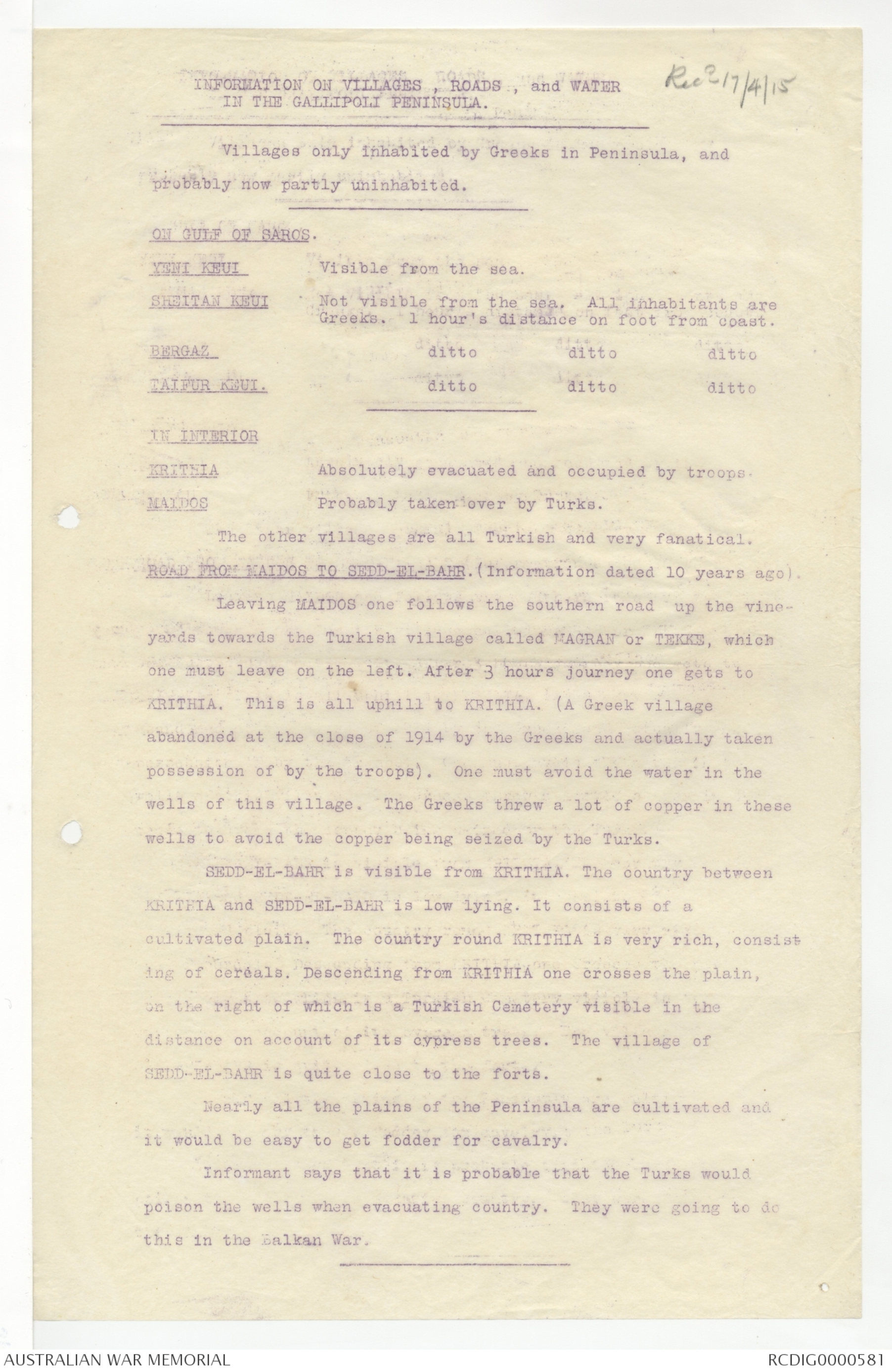
INFORMATION ON VILLAGES, ROADS, and WATER
IN THE GALLIPOLI PENINSULA.
Villages only inhabited by Greeks in Peninsula, and
probably now partly uninhabited.
ON GULF OF SAROS.
YENI KEUI Visible from the sea.
SHEITAN KEUI Not visible from the sea. All inhabitants are
Greeks. 1 hour's distance on foot from coast.
BERGAZ ditto ditto ditto
TAIFUR KEUI. ditto ditto ditto
IN INTERIOR
KRITNIA Absolutely evacuated and occupied by troops.
MAIDOS Probably taken over by Turks.
The other villages are all Turkish and very fanatical.
ROAD FROM MAIDOS TO SEDD-EL-BAHR. (Information dated 10 years ago).
Leaving MAIDOS one follows the southern road up the vineyards
towards the Turkish village called MAGRAN or TEKKE, which
one must leave on the left. After 3 hours journey one gets to
KRITHIA. This is all uphill to KRITHIA. (A Greek village
abandoned at the close of 1914 by the Greeks and actually taken
possession of by the troops). One must avoid the water in the
wells of this village. The Greeks threw a lot of copper in these
wells to avoid the copper being seized by the Turks.
SEDD-EL-BAHR is visible from KRITHIA. The country between
KRITHIA and SEDD-EL-BAHR is low lying. It consists of a
cultivated plain. The country round KRITHIA is very rich, consisting
of cereals. Descending from KRITHIA one crosses the plain,
on the right of which is a Turkish Cemetery visible in the
distance on account of its cypress trees. The village of
SEDD-EL-BAHR is quite close to the forts.
Nearly all the plains of the Peninsula are cultivated and
it would be easy to get fodder for cavalry.
Informant says it is probable that the Turks would
poison the wells when evacuating country. They were going to do
this in the Balkan War.
Recd 17/4/15
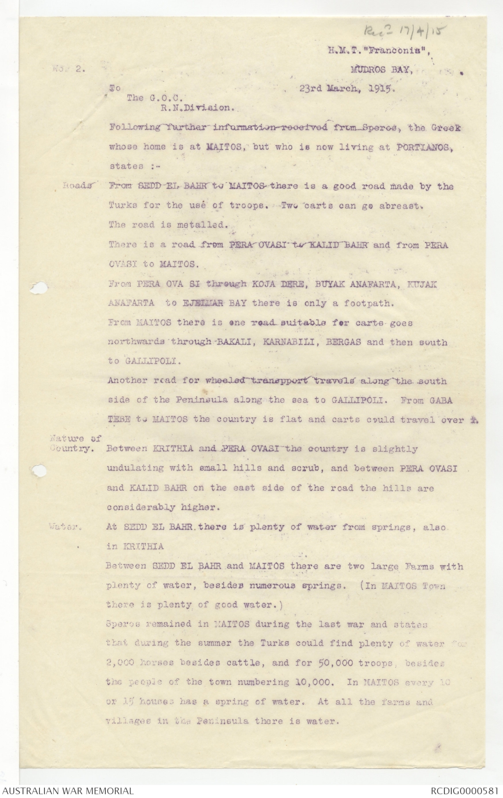
H.M.T. "Franconia"
No. 2.
MUDROS BAY,
23rd March, 1915.
To
The G.O.C.
R.N.Division.
Following further information received from Speros, the Greek
whose home is at MAITOS, but who is now living at PORTIANOS,
states :-
Roads
From SEDD-EL-BAHR to MAITOS there is a good road made by the
Turks for the use of troops. Two carts can go abreast.
The road is metalled.
There is a road from PERA OVASI to KALID BAHR and from PERA
OVASI to MAITOS.
From PERA OVA SI through KOJA DERE, BUYAK ANAFARTA, KUJAK
ANAFARTA to EJELMAR BAY there is only a footpath.
From MAITOS there is one road suitable for carts goes
northwards through BAKALI, KARNABILI, BERGAS and then south
to GALLIPOLI.
Another road for wheeled transport travels along the south
side of the Peninsula along the sea to GALLIPOLI. From GABA
TEBE to MAITOS the country is flat and carts could travel over x.
Nature of Country.
Between KRITHIA and PERA OVASI the country is slightly
undulating with small hills and scrub, and between PERA OVASI
and KALID BAHR on the east side of the road the hills are
considerably higher.
Water.
At SEDD EL BAHR there is plenty of water from springs, also
in KRITHIA
Between SEDD EL BAHR and MAITOS there are two large Farms with
plenty of water, besides numerous springs. (In MAITOS Town
there is plenty of good water.)
Speros remained in MAITOS during the last war and states
that during the summer the Turks could find plenty of water
2,000 horses beside cattle, and for 50,000 troops, besides
the people of the town numbering 10,000. In MAITOS every 10
or 15 houses has a spring of water. At all the farms and
villages in the Peninsula there is water.
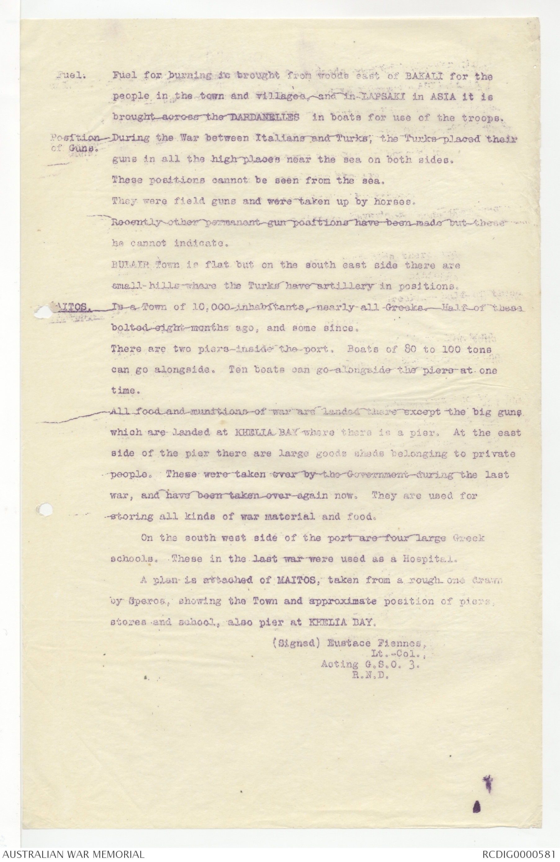
Fuel.
Fuel for burning is brought from woods east of BAKALI for the
people in the town and villages, and in LAPSAKI in ASIA it is
brought across the DARDANELLES in boats for use of the troops.
Position of Guns.
During the War between Italians and Turks, the Turks placed their
guns in all the high places near the sea on both sides.
These positions cannot be seen from the sea.
They were field gun and were taken up by horses.
Recently other permanent gun positions have been made but these
he cannot indicate.
BULAIR Town is flat on the south east side there are
small hills where the Turks have artillery in positions.
MAITOS.
Is a Town of 10,000 inhabitants, nearly all Greeks. Half of these
bolted eight months ago, and some since.
There are two piers inside the port. Boats of 80 to 100 tons
can go alongside. Ten boats can go alongside the piers at one
time.
All food and munitions of war are landed there except the big guns
which are landed at KHELIA BAY where there is a pier. At the east
side of the pier there are large goods sheds belonging to private
people. These were taken over by the Government during the last
war, and have been taken over again now. They are used for
storing all kinds of war material and food.
On the south west side of the port are four large Greek
schools. These in the last war were used as a Hospital.
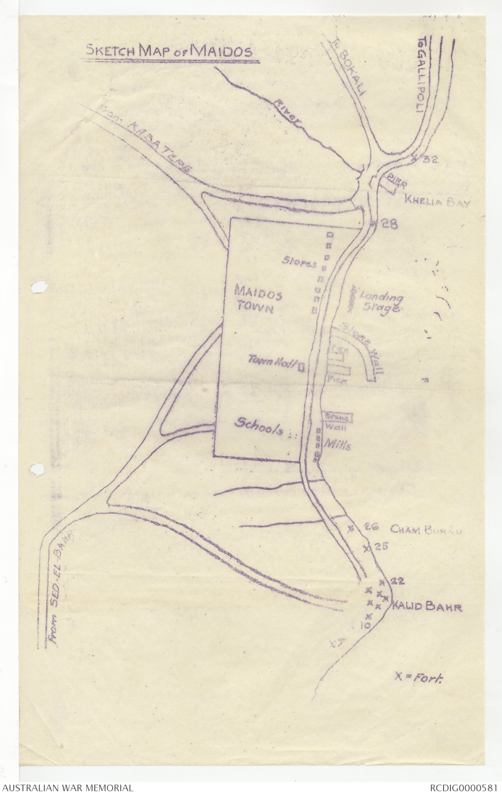
A plan is attached of MAITOS, taken from a rough one drawn
by Speros, showing the Town and approximate position of piers,
stores and school, also pier at KHELIA BAY.
(Signed) Eustace Fiennes,
Lt.-Col.,
Acting G.S.O. 3.
R.N.D.
SKETCH MAP of MAIDOS
Recd 17/4/15
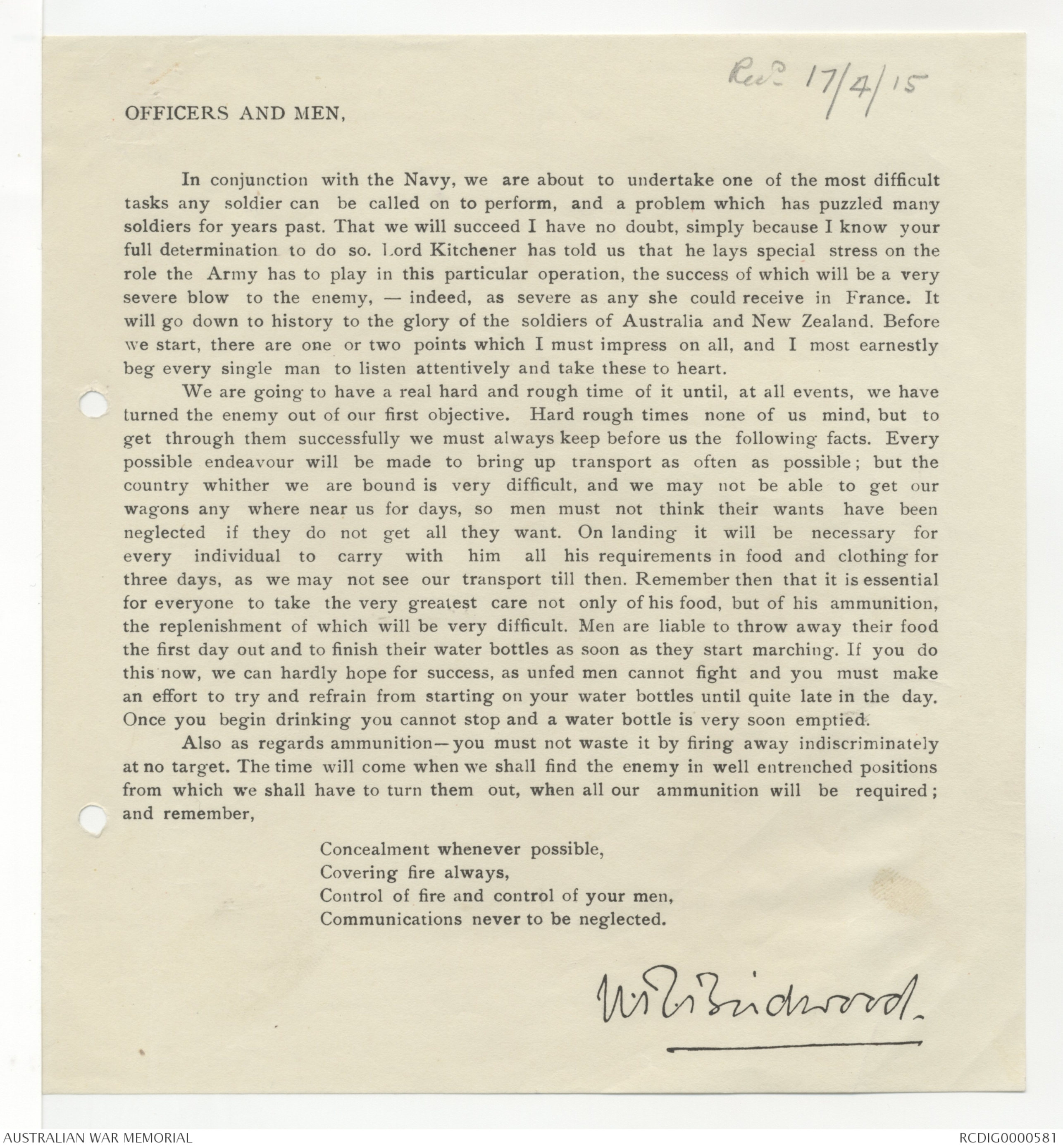
OFFICERS AND MEN,
In conjunction with the Navy, we are about to undertake one of the most difficult
tasks any soldier can be called on to perform, and a problem which has puzzled many
soldiers for years past. That we will succeed I have no doubt, simply because I know your
full determination to do so. Lord Kitchener has told us that he lays special stress on the
role the Army has to play on this particular operation, the success of which will be a very
severe blow to the enemy, - indeed, as severe as any she could receive in France. It
will go down to history to the glory of the soldiers of Australia and New Zealand. Before
we start, there are one or two points which I must impress on all, and I most earnestly
beg every single man to listen attentively and take these to heart.
We are going to have a real hard and rough time of it until, at all events, we have
turned the enemy out of our first objective. Hard rough times none of us mind, but to
get through them successfully we must always keep before us the following facts. Every
possible endeavour will be made to bring up transport as often as possible; but the
country whither we are bound is very difficult, and we may not be able to get our
wagons any where near us for days, so men must not think their wants have been
neglected if they do not get all they want. On landing it will be necessary for
every individual to carry with him all his requirements in food and clothing for
three days, as we may not see our transport till then. Remember then that it is essential
for everyone to take the very greatest care not only of his food, but of his ammunition,
the replenishment of which will be very difficult. Men are liable to throw away their food
the first day out and to finish their water bottles as soon as they start marching. If you do
this now, we can hardly hope for success, as unfed men cannot fight and you must make
an effort to try and refrain from starting on your water bottles until quite late in the day.
Once you begin drinking you cannot stop and a water bottle is very soon emptied.
Also as regards ammunition - you must not waste it by firing away indiscriminately
at no target. The time will come when we shall find the enemy in well entrenched positions
from which we shall have to turn them out, when all our ammunition will be required;
and remember,
Concealment whenever possible,
Covering fire always,
Control of fire and control of your men,
Communications never to be neglected.
W R Birdwood
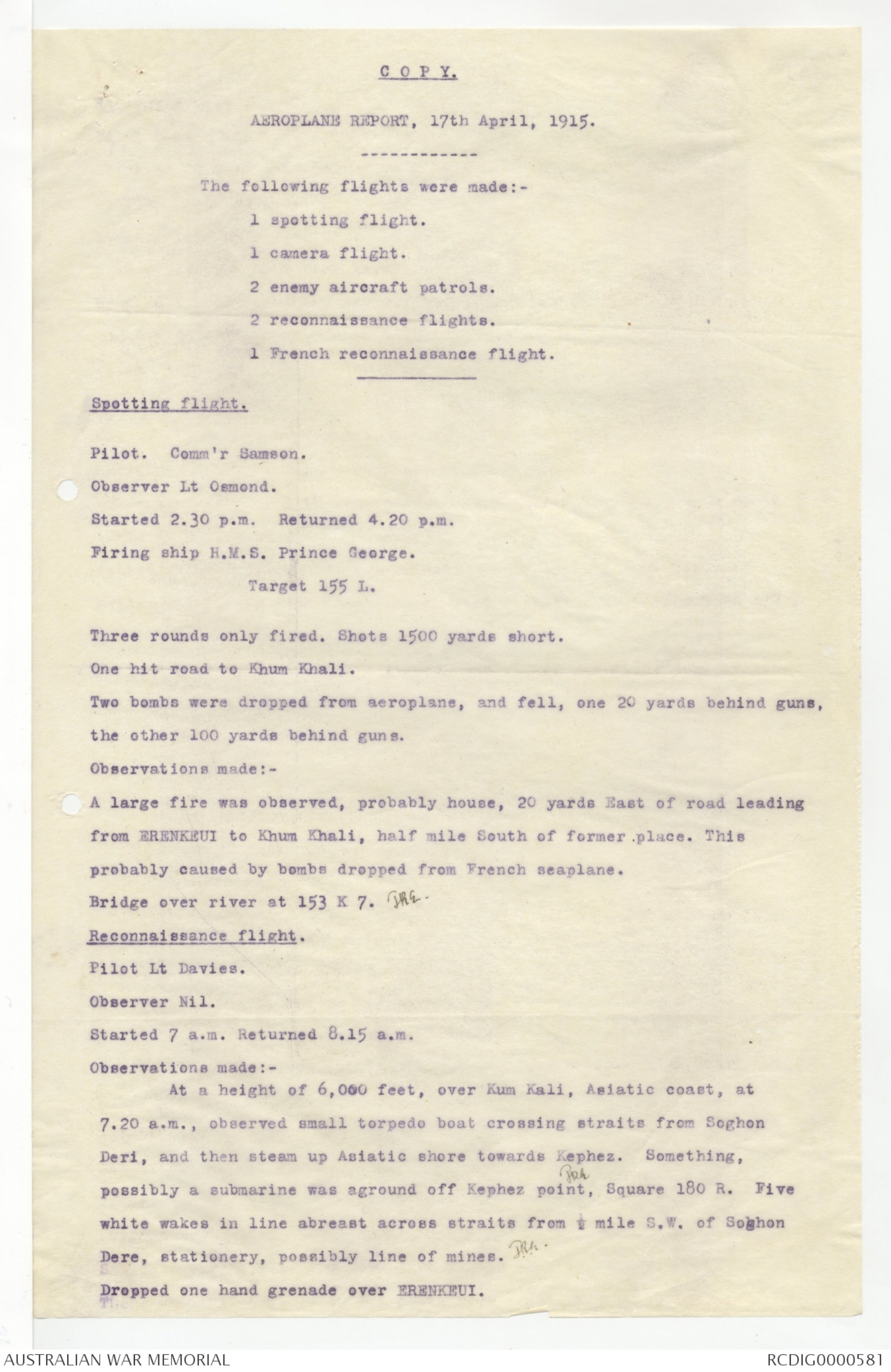
C O P Y.
AEROPLANE REPORT, 17th April, 1915.
The following flights were made:-
1 spotting flight.
1 camera flight.
2 enemy aircraft patrols.
2 reconnaissance flights.
1 French reconnaissance flight.
Spotting flight.
Pilot. Comm'r Samson.
Observer Lt Osmond.
Started 2.30 p.m. Returned 4.20 p.m.
Firing ship H.M.S. Prince George.
Target 155L.
Three rounds only fired. Shots 1500 yards short.
One hit road to Khum Khali.
Two bombs were dropped from aeroplane, and fell, one 20 yards behind guns,
the other 100 yards behind guns.
Observations made:-
A large fire was observed, probably house, 20 yards East of road leading
from ERENKEUI to Khum Khali, half mile South of former place. This
probably caused by bombs dropped from French seaplane.
Bridge over river at 153 K 7. JRE.
Reconnaissance flight.
Pilot Lt Davies.
Observer Nil.
Started 7 a.m. Returned 8.15 a.m.
Observations made:-
At a height of 6,000 feet, over Kum Kali, Asiatic coast, at
7.20 a.m., observed small torpedo boat crossing straits from Soghon
Deri, and then steam up Asiatic shore towards Kephez. Something,
possibly a submarine was aground off Kephez point, JRE Square 180 R. Five
white wakes in line abreast across straits from ½ mile S.W. of Soghon
Dere, stationery, possibly line of mines. JRE.
Dropped one hand grenade over ERENKEUI.
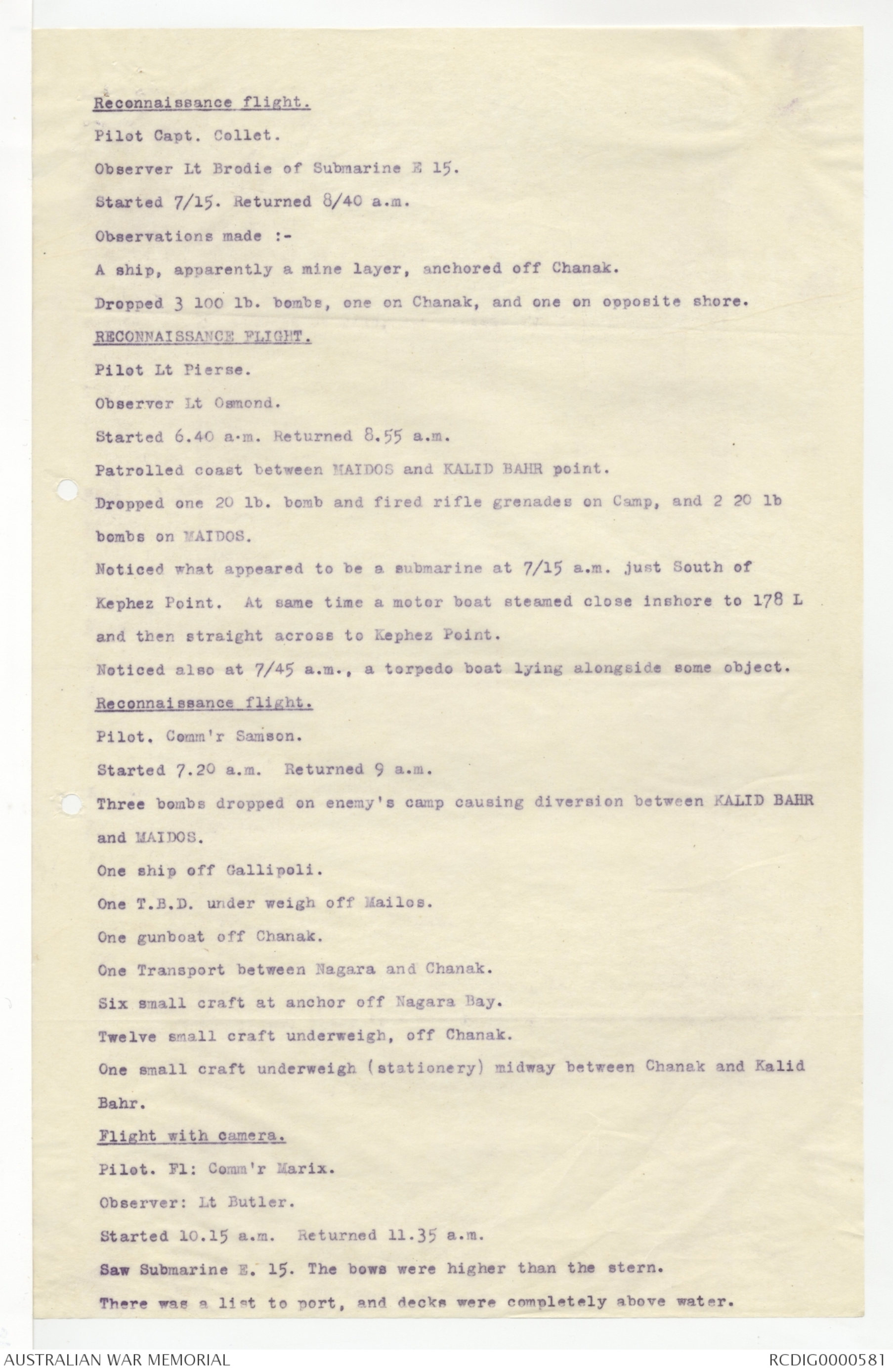
Reconnaissance flight.
Pilot Capt. Collet.
Observer Lt Brodie of Submarine E 15.
Started 7/15. Returned 8/40 a.m.
Observations made:-
A ship, apparently a mine layer, anchored off Chanak.
Dropped 3 100 lb. bombs, one on Chanak, and one on opposite shore.
RECONNAISSANCE FLIGHT.
Pilot Lt Pierse.
Observer Lt Osmond.
Started 6.40 a.m. Returned 8.55 a.m.
Patrolled coast between MAIDOS and KALID BAHR point.
Dropped one 20 lb. bomb and fired rifle grenades on Camp, and 2 20 lb
bombs on MAIDOS.
Noticed what appeared to be a submarine at 7/15 a.m. just South of
Kephez Point. At same time a motor boat steamed close inshore to 178 L
and then straight across to Kephez Point.
Noticed also at 7/45 a.m., a torpedo boat lying alongside some object.
Reconnaissance flight.
Pilot. Comm'r Samson.
Started 7.20 a.m. Returned 9 a.m.
Three bombs dropped on enemy's camp causing diversion between KALID BAHR
and MAIDOS.
One ship off Gallipoli.
One T.B.D. under weigh off Mailos.
One gunboat off Chanak.
One Transport between Nagara and Chanak.
Six small craft at anchor off Nagara Bay.
Twelve small craft underweigh, off Chanak.
One small craft underweigh (stationery) midway between Chanak and Kalid
Bahr.
Flight with camera.
Pilot. Fl: Comm'r Marix.
Observer: Lt Butler.
Started 10.15 a.m. Returned 11.35 a.m.
Saw Submarine E.15. The bows were higher than the stern.
There was a list to port, and decks were completely above water.
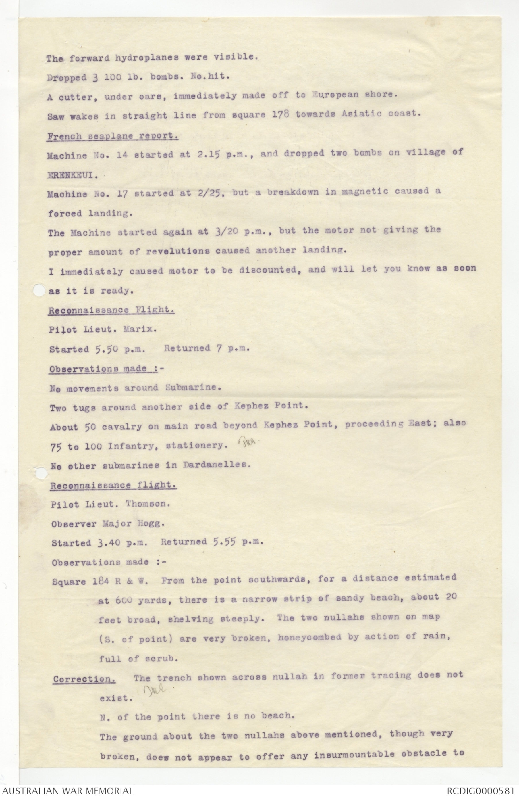
The forward hydroplanes were visible.
Dropped 3 100 lb. bombs. No. hit.
A cutter, under oars, immediately made off to European shore.
Saw wakes in straight line from square 178 towards Asiatic coast.
French seaplane report.
Machine No. 14 started at 2.15 p.m., and dropped two bombs on village of
ERENKEUI.
Machine No. 17 started at 2/25, but a breakdown in magnetic caused a
forced landing.
The Machine started again at 3/20 p.m., but the motor not giving the
proper amount of revolutions caused another landing.
I immediately caused motor to be discounted, and will let you know as soon
as it is ready.
Reconnaissance Flight.
Pilot Lieut. Marix.
Started 5.50 p.m. Returned 7 p.m.
Observations made :-
No movements around Submarine.
Two tugs around another side of Kephez Point.
About 50 cavalry on main road beyond Kephez Point, proceeding East; also
75 to 100 Infantry, stationery. JRE
No other submarine in Dardanelles.
Reconnaissance flight.
Pilot Lieut. Thomson.
Observer Major Hogg.
Started 3.40 p.m. Returned 5.55 p.m.
Observations made :-
Square 184 R & W. From the point southwards, for a distance estimated
at 600 yards, there is a narrow strip of sandy beach, about 20
feet broad, shelving steeply. The two nullahs shown on map
(S. of point) are very broken, honeycombed by action of rain,
full of scrub.
Correction. The trench shown across nullah in former tracing does not
exist. JRE.
N. of the point there is no beach.
The ground about the two nullahs above mentioned, though very
broken, does not appear to offer any insurmountable obstacle to
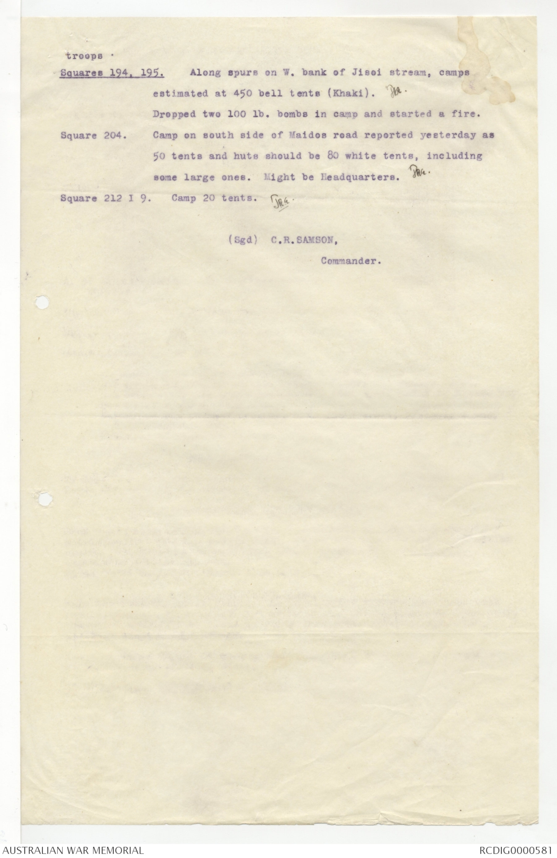
troops.
Squares 194, 195. Along spurs on W. bank of Jisoi stream, camps
estimated at 450 bell tents (Khaki). JRE.
Dropped two 100 lb. bombs in camp and started a fire.
Square 204. Camp on south side of Maidos road reported yesterday as
50 tents and huts should be 80 white tents, including
some large ones. Might be Headquarters. JRE.
Square 212 I 9. Camp 20 tents. JRE.
(Sgd) C.R.SAMSON,
Commander.
 Jacqueline Kennedy
This transcription item is now locked to you for editing. To release the lock either Save your changes or Cancel.
This lock will be automatically released after 60 minutes of inactivity.