Charles E W Bean, Diaries, AWM38 3DRL 606/232/1 - Folder - Part 6
27.
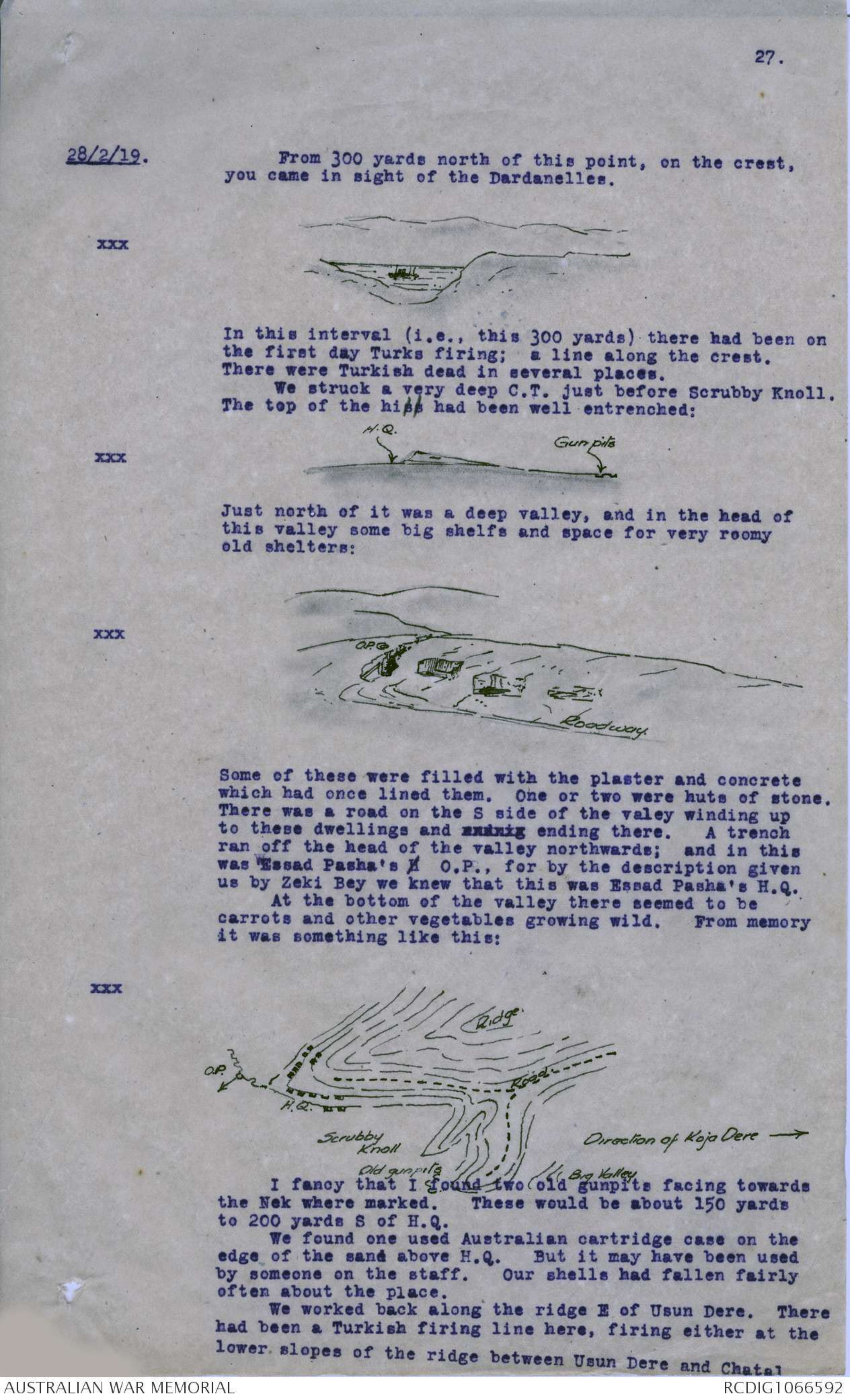
28/2/19. From 300 yards north of this point, on the crest,
you came in sight of the Dardanelles.
xxx Diagram - see original
In this interval (i.e., this 300 yards) there had been on
the first day Turks firing; a line along the crest.
There were Turkish dead in several places.
We struck a very deep C.T. just before Scrubby Knoll.
The top of the hill had been well entrenched:
xxx Diagram - see original
Just north of it was a deep valley, and in the head of
this valley some big shelfs and space for very roomy
old shelters:
xxx Diagram - see original
Some of these were filled with the plaster and concrete
which had once lined them. One or two were huts of stone.
There was a road on the S side of the valey winding up
to these dwellings and xxxxxx ending there. A trench
ran off the head of the valley northwards; and in this
was Essad Pasha's H O.P., for by the description given
us by Zeki Bey we knew that this was Essad Pasha's H.Q.
At the bottom of the valley there seemed to be
carrots and other vegetables growing wild. From memory
it was something like this:
xxx Diagram - see original
I fancy that I found two old gunpits facing towards
the Nek where marked. These would be about 150 yards
to 200 yards S of H.Q.
We found one used Australian cartridge case on the
edge of the sand above H.Q. But it may have been used
by someone on the staff. Our shells had fallen fairly
often about the place.
We worked back along the ridge E of Usun Dere. There
had been a Turkish firing line here, firing either at the
lower slopes of the ridge between Usun Dere and Chatal
28.
28/2/19. Dere (Tulloch's Ridge); or at the upper end of Mortar R.
(Baby 700 way). Tulloch Ridge would be about 300 to
350 yards, Mortar Ridge 700 to 1000. There were some
signs of our kit on the road leading down xxxxxxxxx this
ridge - about 4 torn bits of it carried probably by a
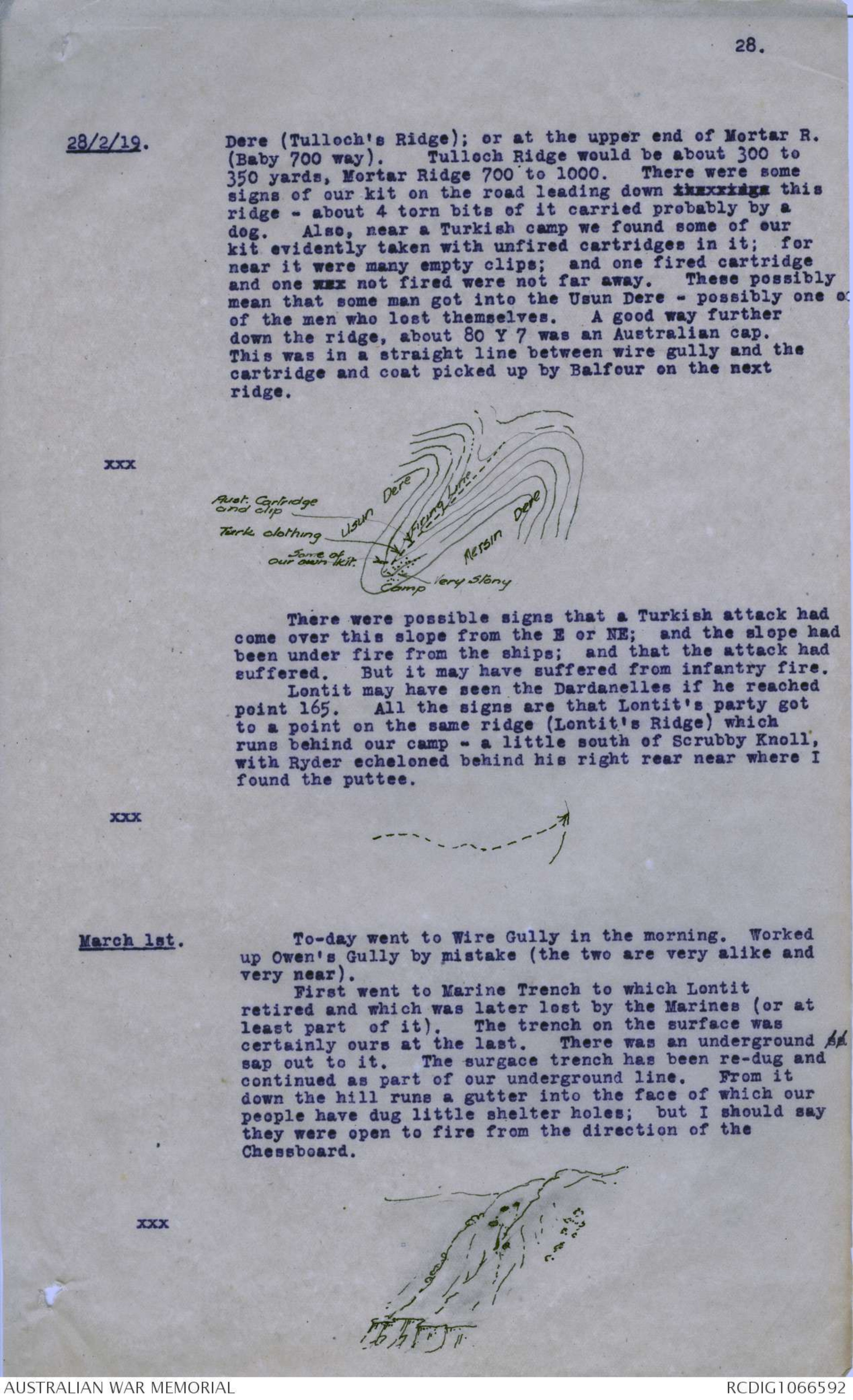
dog. Also, near a Turkish camp we found some of our
kit evidently taken with unfired cartridges in it; for
near it were many empty clips; and one fired cartridge
and one xxx not fired were not far away. These possibly
mean that some man got into the Usun Dere - possibly one o
of the men who lost themselves. A good way further
down the ridge, about 80 Y 7 was an Australian cap.
This was in a straight line between wire gully and the
cartridge and coat picked up by Balfour on the next
ridge.
xxx Diagram - see original
There were possible signs that a Turkish attack had
come over this slope from the E or NE; and the slope had
been under fire from the ships; and that the attack had
suffered. But it may have suffered from infantry fire.
Lontit may have seen the Dardanelles if he reached
point 165. All the signs are that Lontit's party got
to a point on the same ridge (Lontit's Ridge) which
runs behind our camp - a little south of Scrubby Knoll,
with Ryder echeloned behind his right rear near where I
found the puttee.
xxx Diagram - see original
March 1st. To-day went to Wire Gully in the morning. Worked
up Owen's Gully by mistake (the two are very alike and
very near).
First went to Marine Trench to which Lontit
retired and which was later lost by the Marines (or at
least part of it). The trench on the surface was
certainly ours at the last. There was an underground sa
sap out to it. The surgace trench has been re-dug and
continued as part of our underground line. From it
down the hill runs a gutter into the face of which our
people have dug little shelter holes; but I should say
they were open to fire from the direction of the
Chessboard.
xxx Diagram - see original
29.
1/3/19. There was an old marine's helmet in the trench. The
gutters on the slope behind the trench seemed to have
been filled in largely with dead and later with debris -
several marines' helmets were lying there amongst the
jam tins, etc. In a gutter nearer the Turkish trenches
were a great number of Turks thrown there on the
armistice day, and half buried, by their own people.
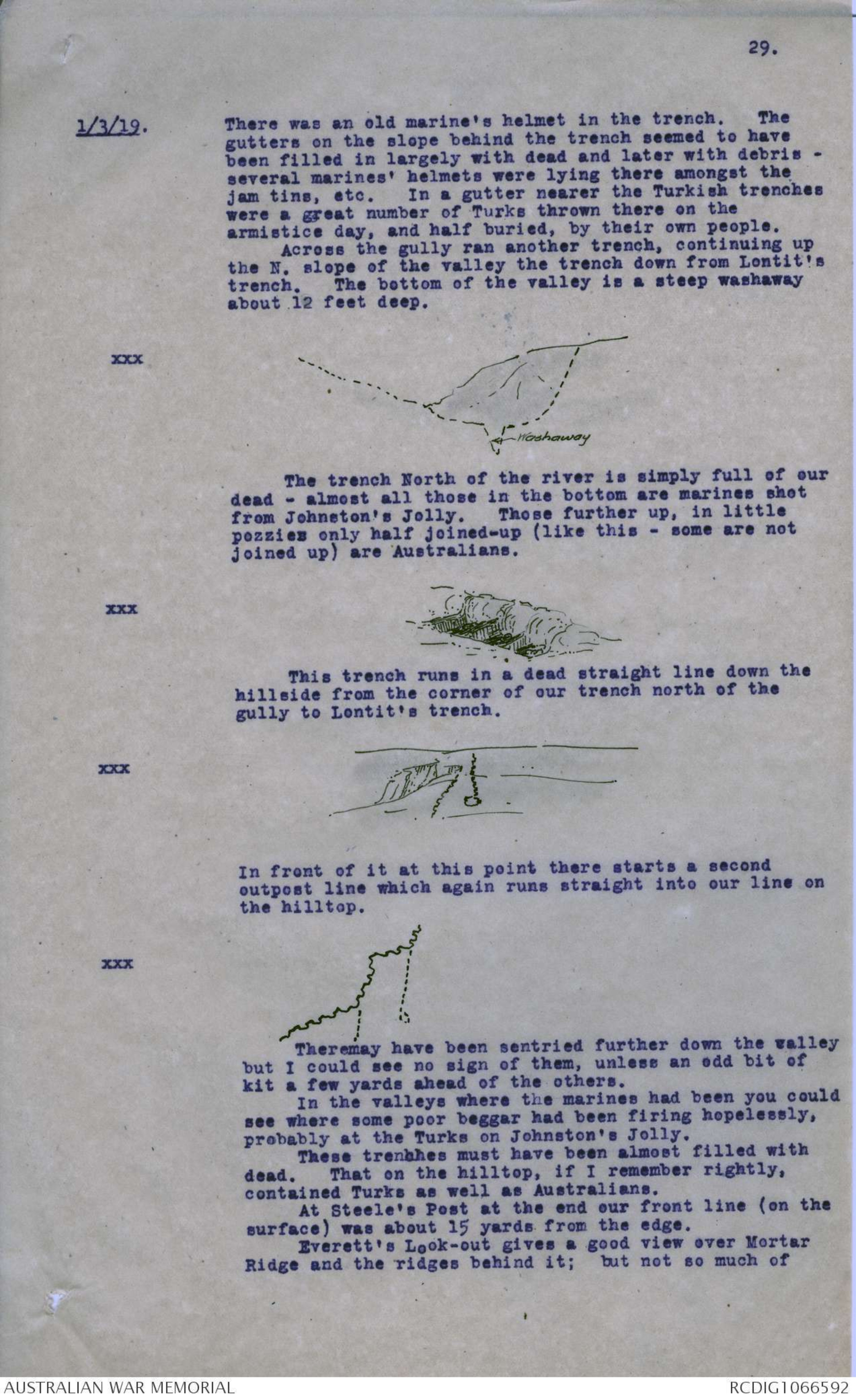
Across the gully ran another trench, continuing up
the N. slope of the valley the trench down from Lontit's
trench. The bottom of the valley is a steep washaway
about. 12 feet deep.
xxx Diagram - see original
The trench North of the river is simply full of our
dead - almost all those in the bottom are marines shot
from Johnston's Jolly. Those further up, in little
pozzies only half joined-up (like this - some are not
joined up) are Australians.
xxx Diagram - see original
This trench runs in a dead straight line down the
hillside from the corner of our trench north of the
gully to Lontit's trench.
xxx Diagram - see original
In front of it at this point there starts a second
outpost line which again runs straight into our line on
the hilltop.
xxx Diagram - see original
Theremay have been sentried further down the valley
but I could see no sign of them, unless an odd bit of
kit a few yards ahead of the others.
In the valleys where the marines had been you could
see where some poor beggar had been firing hopelessly,
probably at the Turks on Johnston's Jolly.
These trenches must have been almost filled with
dead. That on the hilltop, if I remember rightly,
contained Turks as well as Australians.
At Steele's Post at the end our front line (on the
surface) was about 15 yards from the edge.
Everett's Look-out gives a good view over Mortar
Ridge and the ridges behind it; but not so much of
30.
1/3/19. Mule Valley as the O.P.'s further N. You can see the
olive trees and a bit of green at the valley foot from
near here; but from Lontit's position you cannot see the
open ground at the valley foot.
At the valley foot one (or two) knuckles further
down than our trench are Turkish rifle pits scooped
behind the bottom of the knuckle and some fired
cartridges - these are perhaps 100 yards down the valley.
I expect this is where the Turks who pretended to be
Indians got to on the second night at sundown.
I went across the front of Johnston's Jolly in
Nomansland. Here there were lying 2 men, buried
probably at the armistice. They might be two of 4th Bn.
The crest of Johnston's Jolly is a remarkably flat
plateau - very low scrub and quite flat.
xxx Diagram - see original
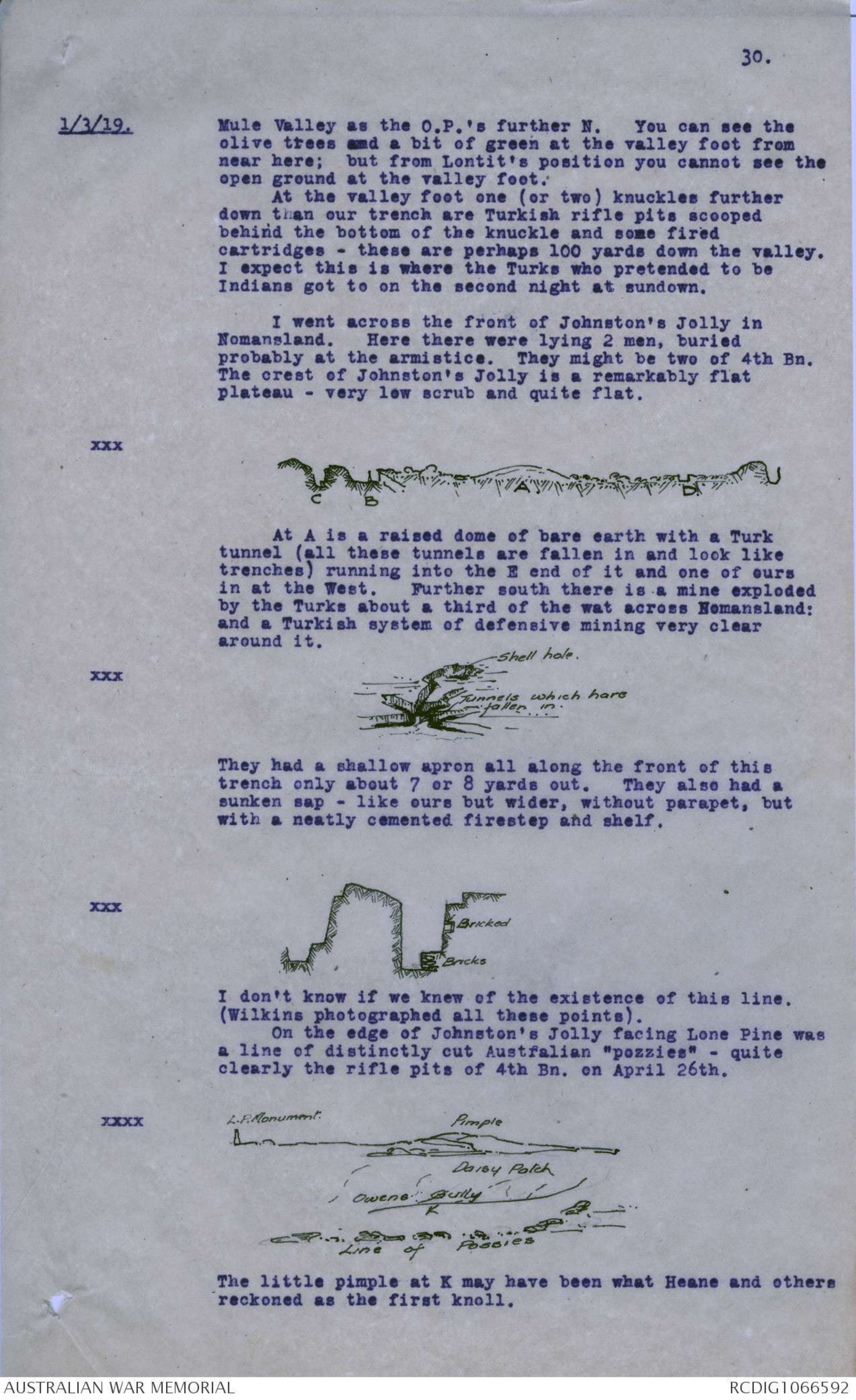
At A is a raised dome of bare earth with a Turk
tunnel (all these tunnels are fallen in and look like
trenches) running into the E end of it and one of ours
in at the West. Further south there is a mine exploded
by the Turks about a third of the wat across Nomansland:
and a Turkish system of defensive mining very clear
around it.
xxx Diagram - see original
They had a shallow apron all along the front of this
trench only about 7 or 8 yards out. They also had
sunken sap - like ours but wider, without parapet, but
with a neatly cemented firestep and shelf.
xxx Diagram - see original
I don't know if we knew of the existence of this line.
(Wilkins photographed all these points).
On the edge of Johnston's Jolly facing Lone Pine was
a line of distinctly cut Austfalian "pozzies" - quite
clearly the rifle pits of 4th Bn. on April 26th.
xxx Diagram - see original
The little pimple at K may have been what Heane and others
reckoned as the first knoll.
31.
1/3/19.
xxx Diagram - see original
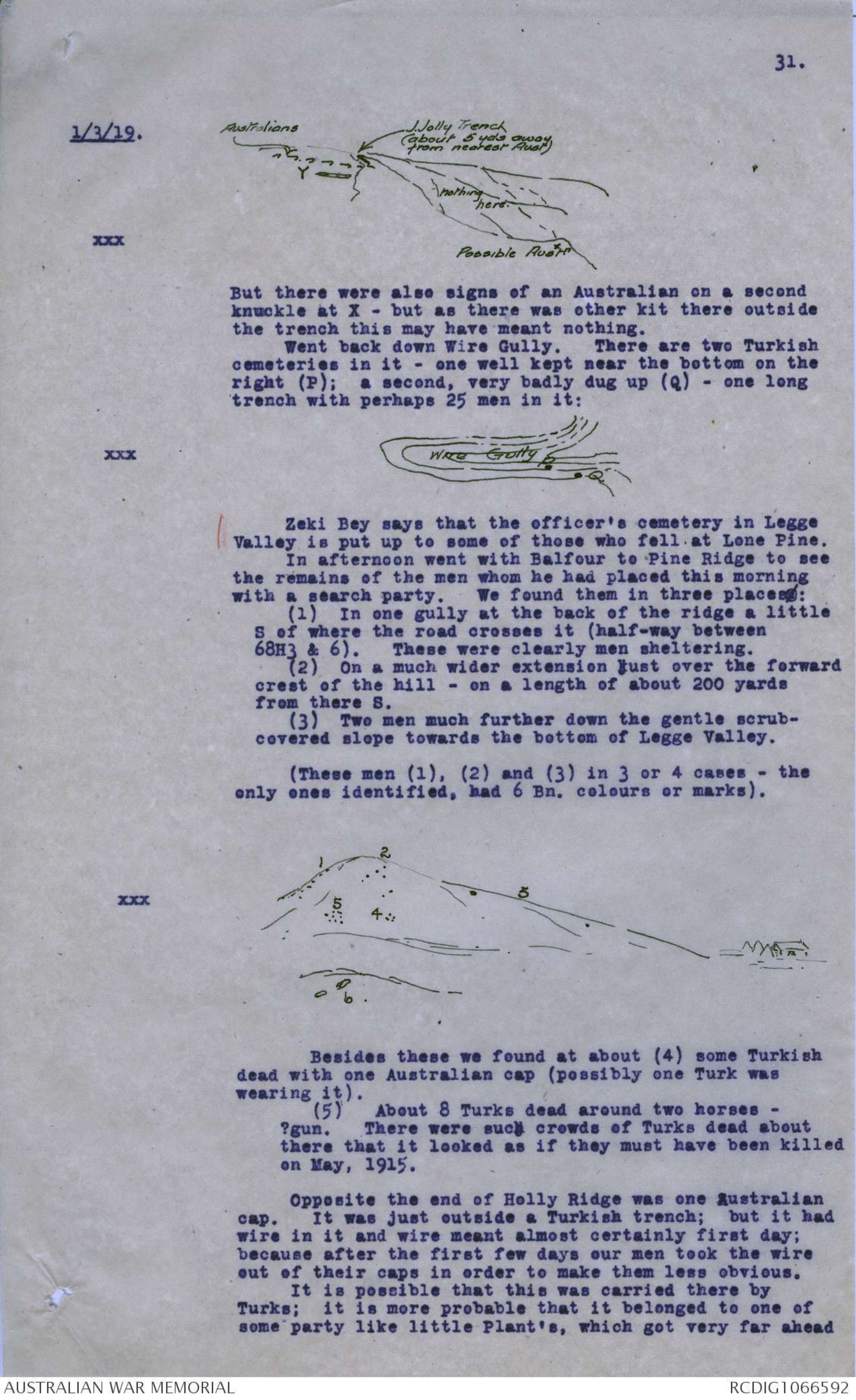
But there were also signs of an Australian on a second
knuckle at X - but as there was other kit there outside
the trench this may have meant nothing.
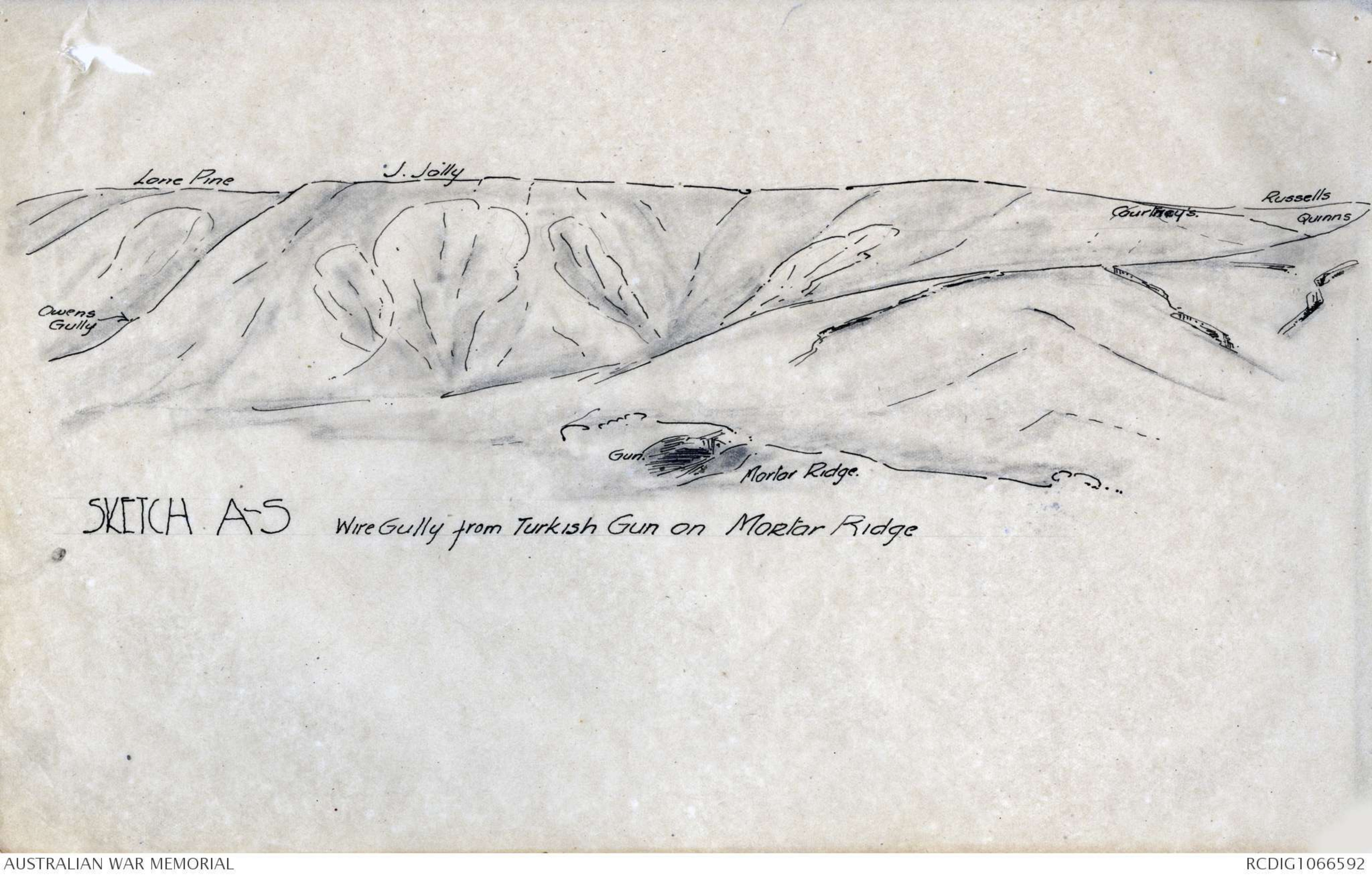
Went back down Wire Gully. There are two Turkish
cemeteries in it - one well kept near the bottom on the
right (P): a second, very badly dug up (Q) - one long
trench with perhaps 25 men in it:
xxx Diagram - see original
Zeki Bey says that the officer's cemetery in Legge
Valley is put up to some of those who fell at Lone Pine.
In afternoon went with Balfour to Pine Ridge to see
the remains of the men whom he had placed this morning
with a search party. We found them in three placesx:
(1) In one gully at the back of the ridge a little
S of where the road crosses it (half-way between
68H3 & 6). These were clearly men sheltering.
(2) On a much wider extension just over the forward
crest of the hill - on a length of about 200 yards
from there S.
(3) Two men much further down the gentle scrub-
covered slope towards the bottom of Legge Valley.
(These men (1), (2) and (3) in 3 or 4 cases - the
only ones identified, had 6 Bn. colours or marks).
xxx Diagram - see original
Besides these we found at about (4) some Turkish
dead with one Australian cap (possibly one Turk was
wearing it).
(5) About 8 Turks dead around two horses -
?gun. There were such crowds of Turks dead about
there that it looked as if they must have been killed
on May, 1915.
Opposite the end of Holly Ridge was one Australian
cap. It was just outside a Turkish trench; but it had
wire in it and wire meant almost certainly first day;
because after the first few days our men took the wire
out of their caps in order to make them less obvious.
It is possible that this was carried there by
Turks; it is more probable that it belonged to one of
some party like little Plant's, which got very far ahead
Diagram - see original
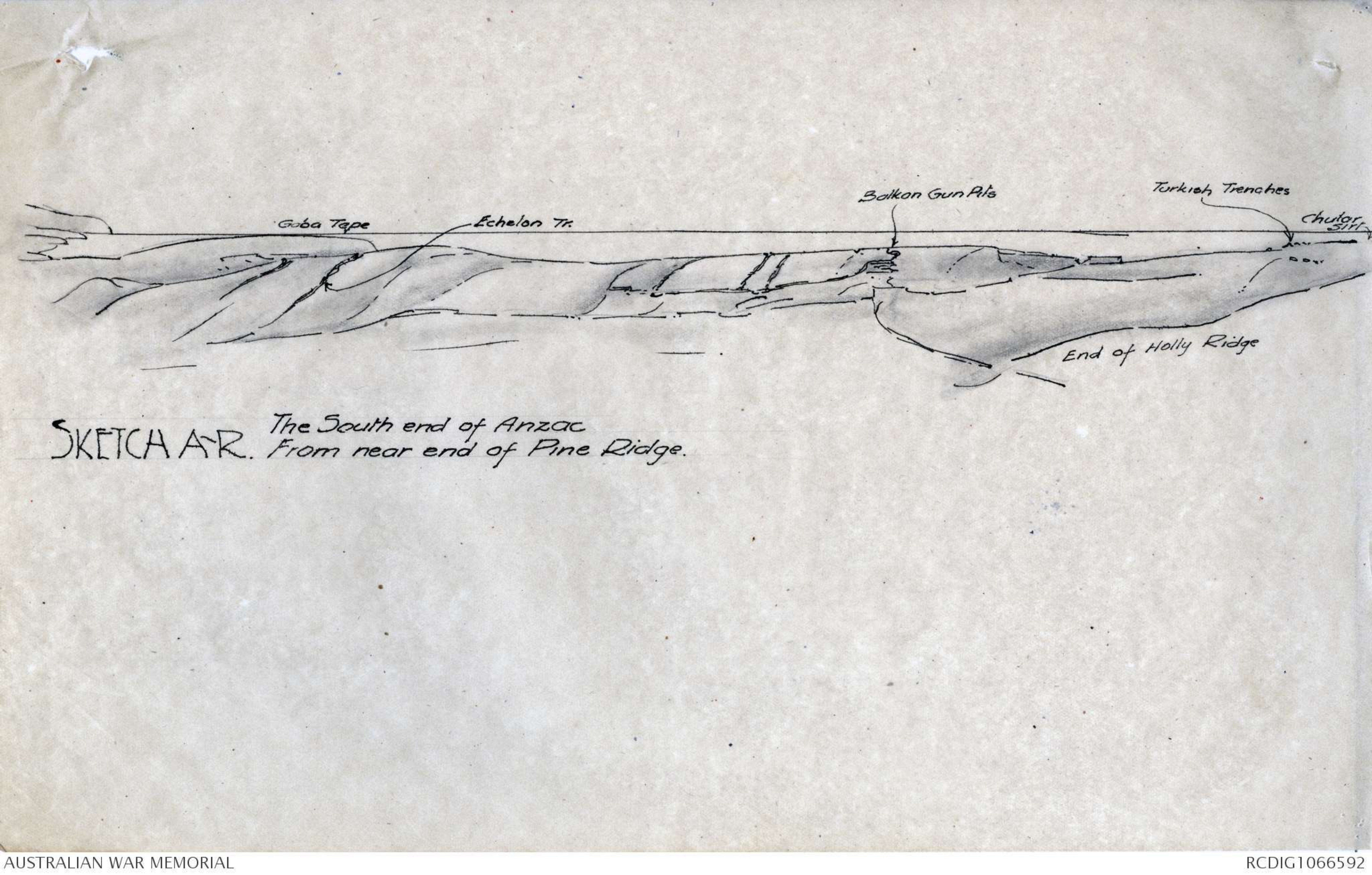
SKETCH A-R The South end of Anzac
From near end of Pine Ridge.
Diagram - see original
SKETCH A-S Wire Gully from Turkish Gun on Mortar Ridge
32.
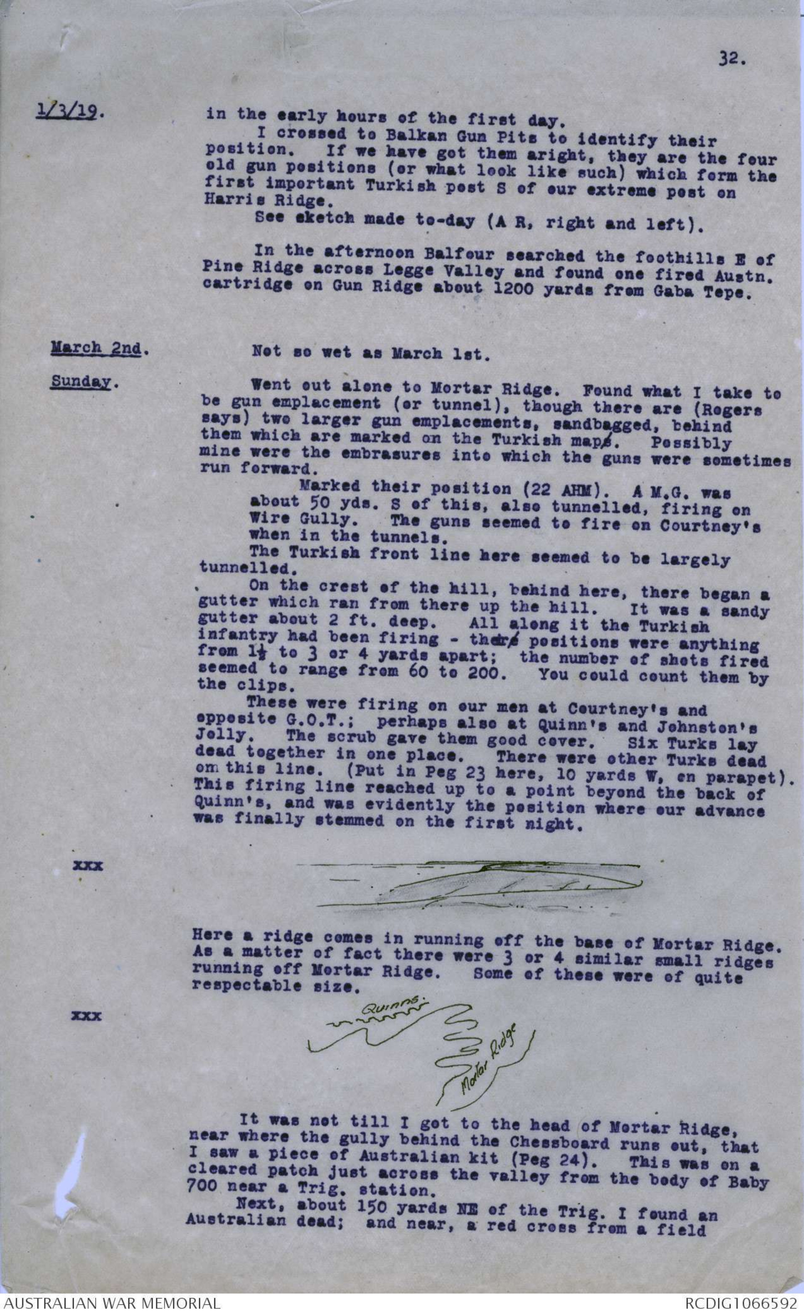
1/3/19. in the early hours of the first day.
I crossed to Balkan Gun Pits to identify their
position. If we have got them aright, they are the four
old gun positions (or what look like such) which form the
first important Turkish post S of our extreme post on
Harris Ridge.
See sketch made to-day (A R, right and left).
In the afternoon Balfour searched the foothills E of
Pine Ridge across Legge Valley and found one fired Austn.
cartridge on Gun Ridge about 1200 yards from Gaba Tepe.
March 2nd. Not so wet as March lst.
Sunday. Went out alone to Mortar Ridge. Found what I take to
be gun emplacement (or tunnel), though there are (Rogers
says) two larger gun emplacements, sandbagged, behind
them which are marked on the Turkish maps. Possibly
mine were the embrasures into which the guns were sometimes
run forward.
Marked their position (22 AHM). A M.G. was
about 50 yds. S of this, also tunnelled, firing on
Wire Gully. The guns seemed to fire on Courtney's
when in the tunnels.
The Turkish front line here seemed to be largely
tunnelled.
On the crest of the hill, behind here, there began a
gutter which ran from there up the hill. It was a sandy
gutter about 2 ft. deep. All along it the Turkish
infantry had been firing - theire positions were anything
from 1½ to 3 or 4 yards apart; the number of shots fired
seemed to range from 60 to 200. You could count them by
the clips.
These were firing on our men at Courtney's and
opposite G.O.T.; perhaps also at Quinn's and Johnston's
Jolly. The scrub gave them good cover. Six Turks lay
dead together in one place. There were other Turks dead
on this line. (Put in Peg 23 here, 10 yards W. on parapet).
This firing line reached up to a point beyond the back of
Quinn's, and was evidently the position where our advance
was finally stemmed on the first night.
xxx Diagram - see original
Here a ridge comes in running off the base of Mortar Ridge.
As a matter of fact there were 3 or 4 similar small ridges
running off Mortar Ridge. Some of these were of quite
respectable size.
xxx Diagram - see original
It was not till I got to the head of Mortar Ridge,
near where the gully behind the Chessboard runs out, that
I saw a piece of Australian kit (Peg 24). This was on a
cleared patch just across the valley from the body of Baby
700 near a Trig. station.
Next, about 150 yards NE of the Trig. I found an
Australian dead; and near, a red cross from a field
Diagram - see original
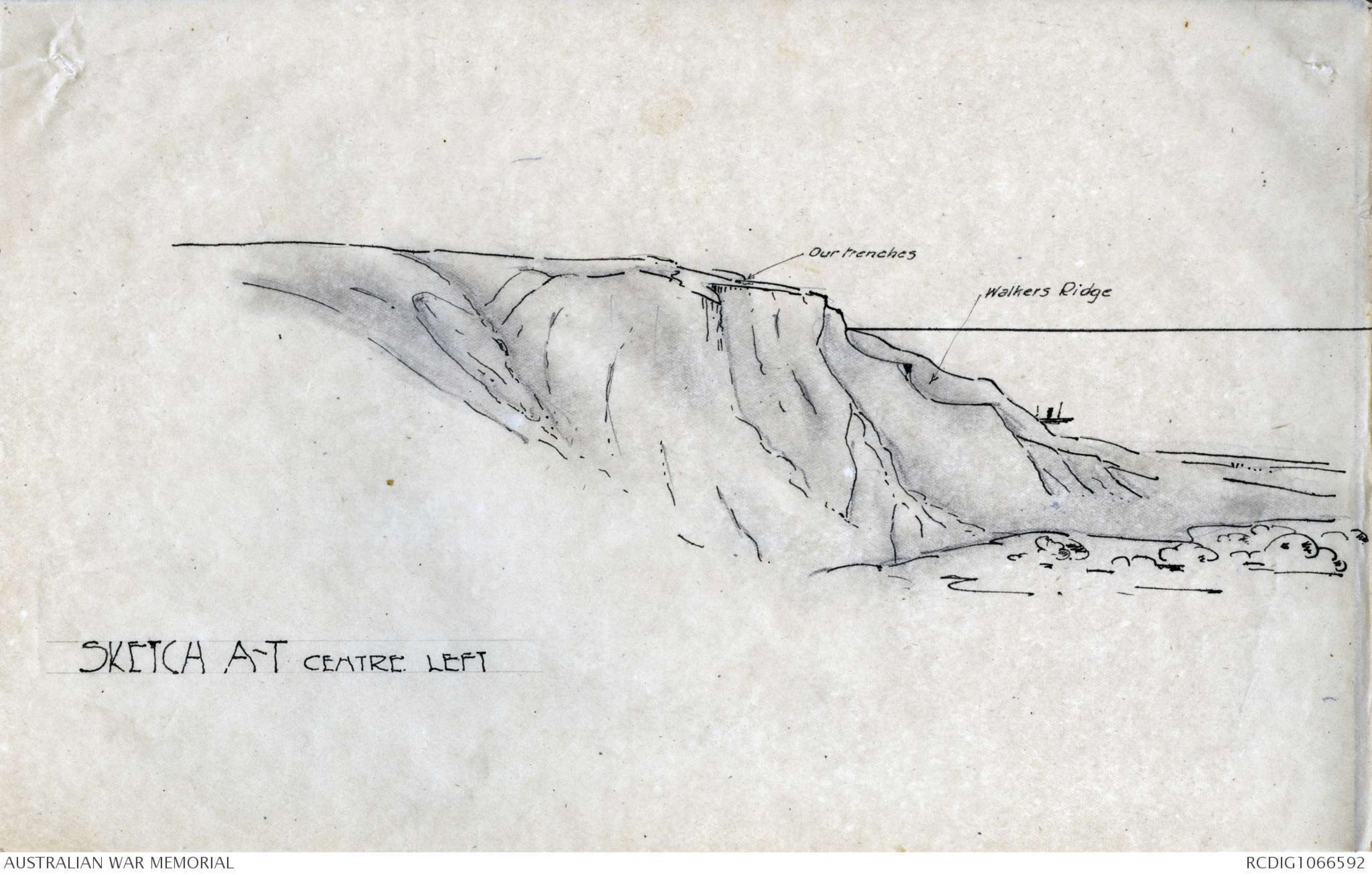
SKETCH A-T CENTRE LEFT
Diagram - see original
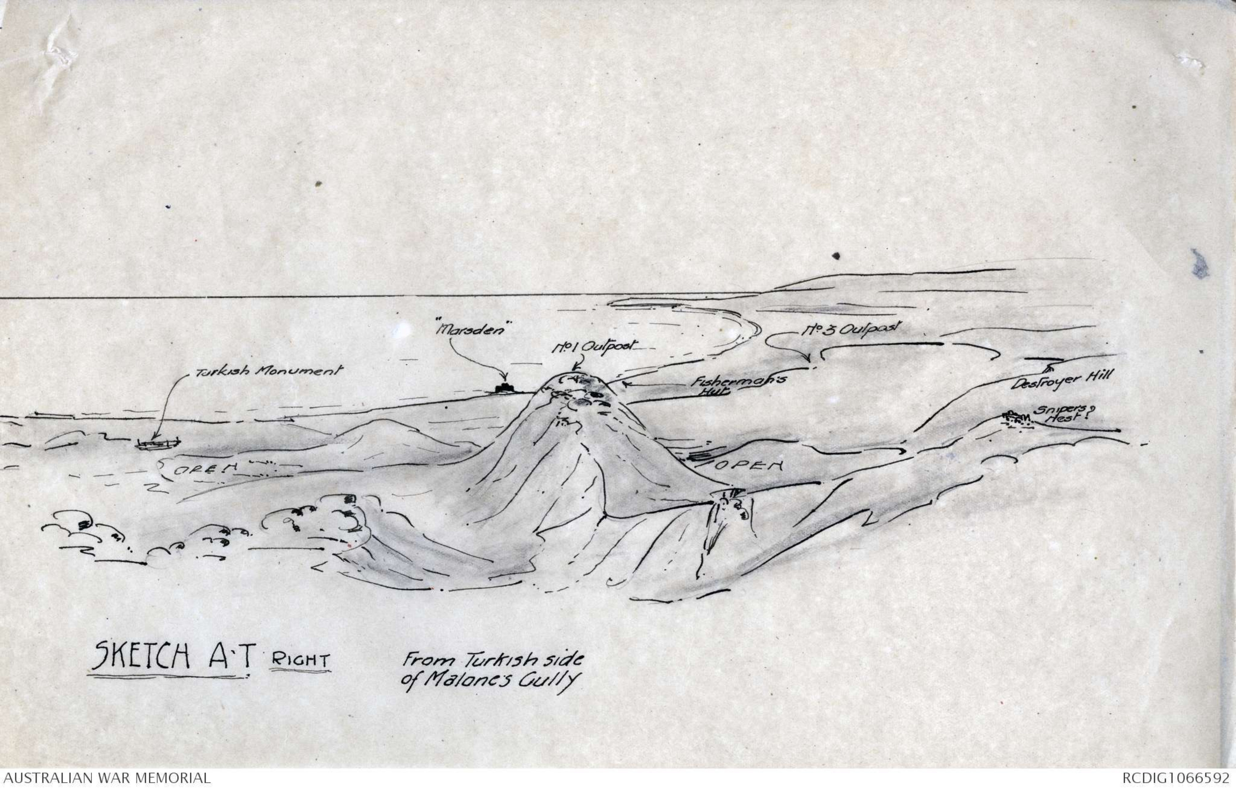
SKETCH A-T RIGHT From Turkish side
of Malone's Gully
 Deb Parkinson
This transcription item is now locked to you for editing. To release the lock either Save your changes or Cancel.
This lock will be automatically released after 60 minutes of inactivity.