Charles E W Bean, Diaries, AWM38 3DRL 606/232/1 - Folder - Part 2
7.
17/2/19. Drake Brockman's Coy. moved down from Plugge's by a
winding path (there are two paths - this was the northern-most
- see sketch in field notebook - taken from (6).
(5) Turk tents.
(6) Where Drake Brockman's Coy. reorganised under
edge of Rest Gully. They were ½-hour at (6). From
here they moved up Shrapnel Valley. (Near the pick handle
stuck in ground - which men thought a mine - at junction
of Rest and Shrapnel valleys - someone gave Howe a box of
ammunition to carry).
In Shrapnel Valley salvoes of 3 shrapnel shell
from direction of 971 began.
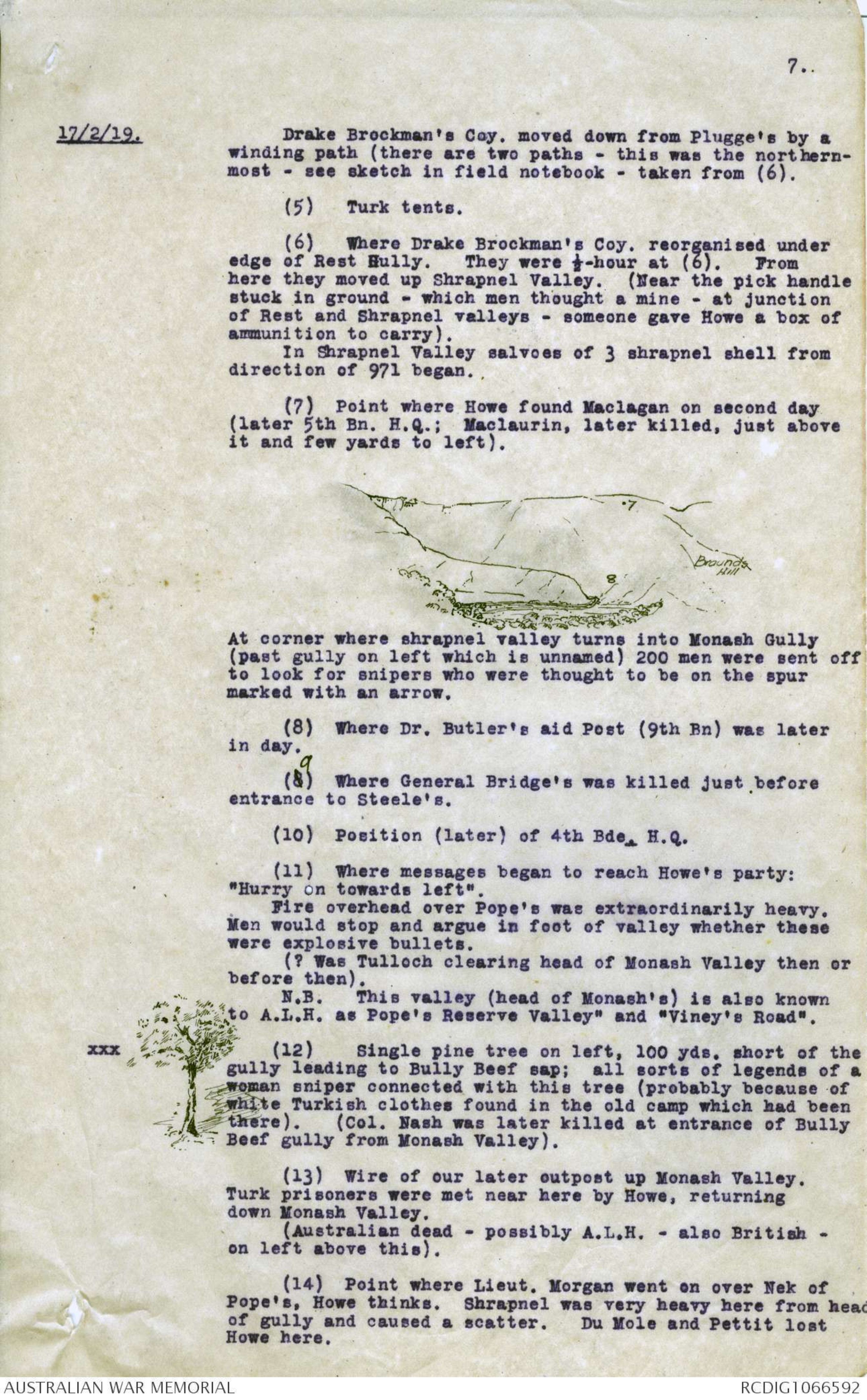
(7) Point where Howe found Maclagan on second day
(later 5th Bn. H.Q.; Maclaurin, later killed, just above
it and few yards to left).
Diagram - see original document
At corner where shrapnel valley turns into Monash Gully
(past gully on left which is unnamed) 200 men were sent off
to look for snipers who were thought to be on the spur
marked with an arrow.
(8) Where Dr. Butler's aid Post (9th Bn) was later
in day.
(8) ^ 9 Where General Bridge's was killed just before
entrance to Steele's.
(10) Position (later) of 4th Bde. H.Q.
(11) Where messages began to reach Howe's party:
"Hurry on towards left".
Fire overhead over Pope's was extraordinarily heavy.
Men would stop and argue in foot of valley whether
these were explosive bullets.
(? Was Tulloch clearing head of Monash Valley then or
before then).
N.B. This valley (head of Monash's) is also known
to A.L.H. as Pope's Reserve Valley" and "Viney's Road".
(12) Single pine tree on left, 100 yds. short of the
gully leading to Bully Beef sap; all sorts of legends of a
woman sniper connected with this tree (probably because of
white Turkish clothes found in the old camp which had been
there). (Col. Nash was later killed at entrance of Bully
Beef gully from Monash Valley).
(13) Wire of our later outpost up Monash Valley.
Turk prisoners were met near here by Howe, returning
down Monash Valley.
(Australian dead - possibly A.L.H. - also British -
on left above this).
(14) Point where Lieut. Morgan went on over Nek of
Pope's, Howe thinks. Shrapnel was very heavy here from head
of gully and caused a scatter. Du Mole and Pettit lost
Howe here.
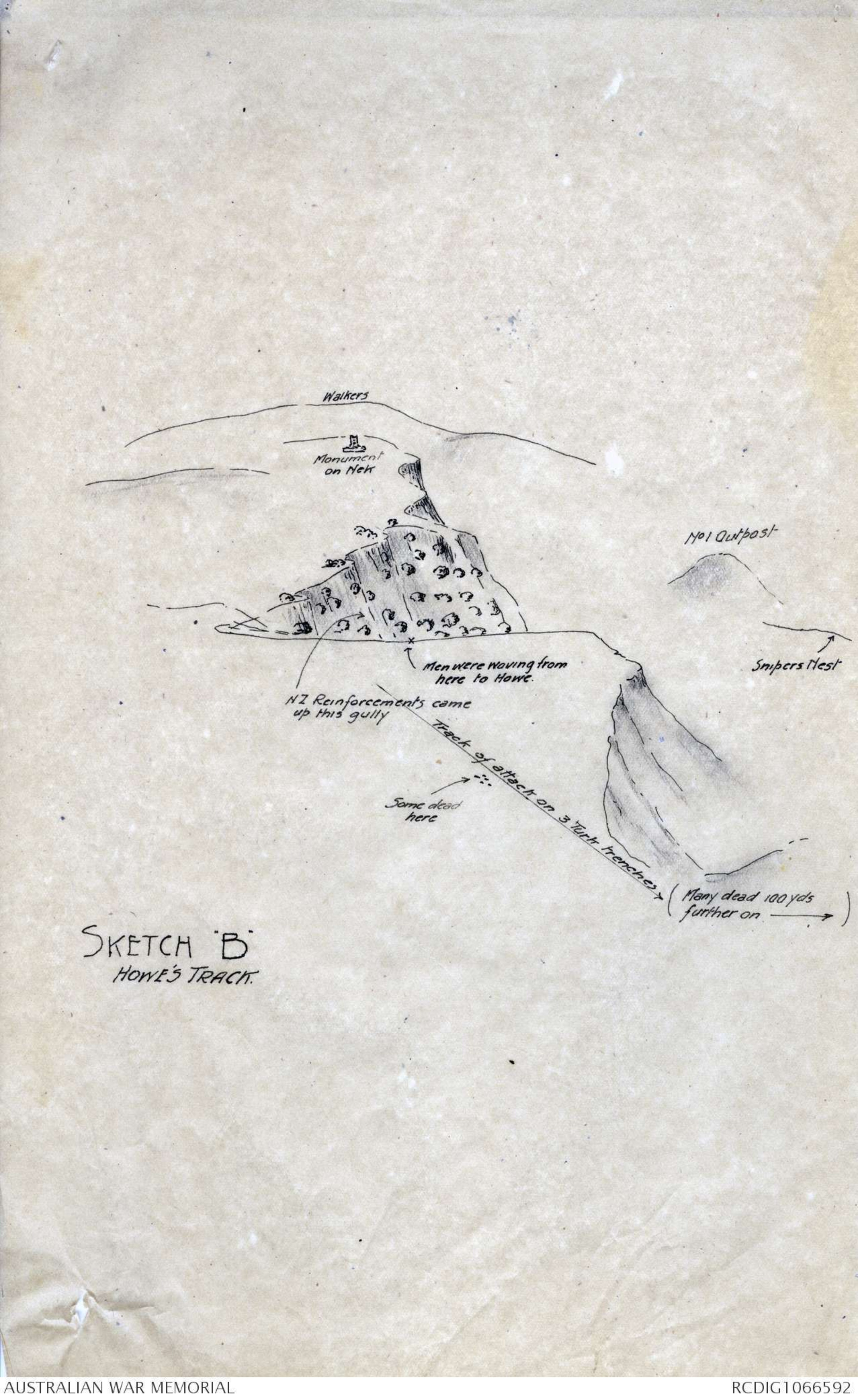
SKETCH "B"
HOWE'S TRACK.
Diagram - see original document
8.
17/2/19. NOTE. - It is more open at the Nek than further to
NE on W end of Baby 700.
E end of Baby 700 also contains open fields where
Turk 6-in. gun is.
(15) Where Howe lay down and fired with men of 12 Bn.
(Shrapnel too hot here, so moved on).
(16) Trenched at which they fired.
(17) A line of men have been buried here by the
Turks, probably exactly where they fell. One was 1st Bn.
One was 2nd Bn. About 40 graves may be here from about
150 to 300 yards S of 6-in. gun. We got xx 1st Bn.
colours off one and 2nd Bn. off another. One piece of kit
was marked NB or MB 1 (or) 12th B or G or 8 11342.
70 yards back towards rear slope of hill was another line
of New Zealanders - some of 16th Coy. (Waikato) and one N.Z.
major.
(18) An Australian or N.Z. mess tin was found here
(may have been from Turkish dump).
Howe had not been (as far as he knew) on the xxx
inland side of Baby 700, so far as this. He took me over to
the ridges on the north side of Baby 700.
His track has been xxxxxxxxxxxxx as shewn in sketch B
in my field notes, across a little knuckle and on to the
main top shoulder of Sniper's Nest on Baby 700. Got to the
crest and the fire became very heavy as they cleared the
crest. Here many men were dead. We found them there.
(I have asked Buchanan to find this spot and mark it 22).
Howe says they saw the Turks coming down Chunuk or 161
or Battleship Hill, and also on the lower slopes of Rhodo,
where there is a small square open patch which Howe thinks
he remembers.
When Howe retired the Turks followed and an officer
appeared (whom Howe shot) about 150 to 200 yards N of the
6-in. gun position.
Howe withdrew towards where they had seen men earlier
(probably, he thinks) the line of 1st, 2nd and other Bn.
on S slope of Baby 700. But by this time they could not
see anyone on top of Baby 700 and so came back onto a Nek
where he ran over a N.Z. M.G.; and there they dug in in a
semi-circle. Isolated men came in later during the
evening from ahead of them.
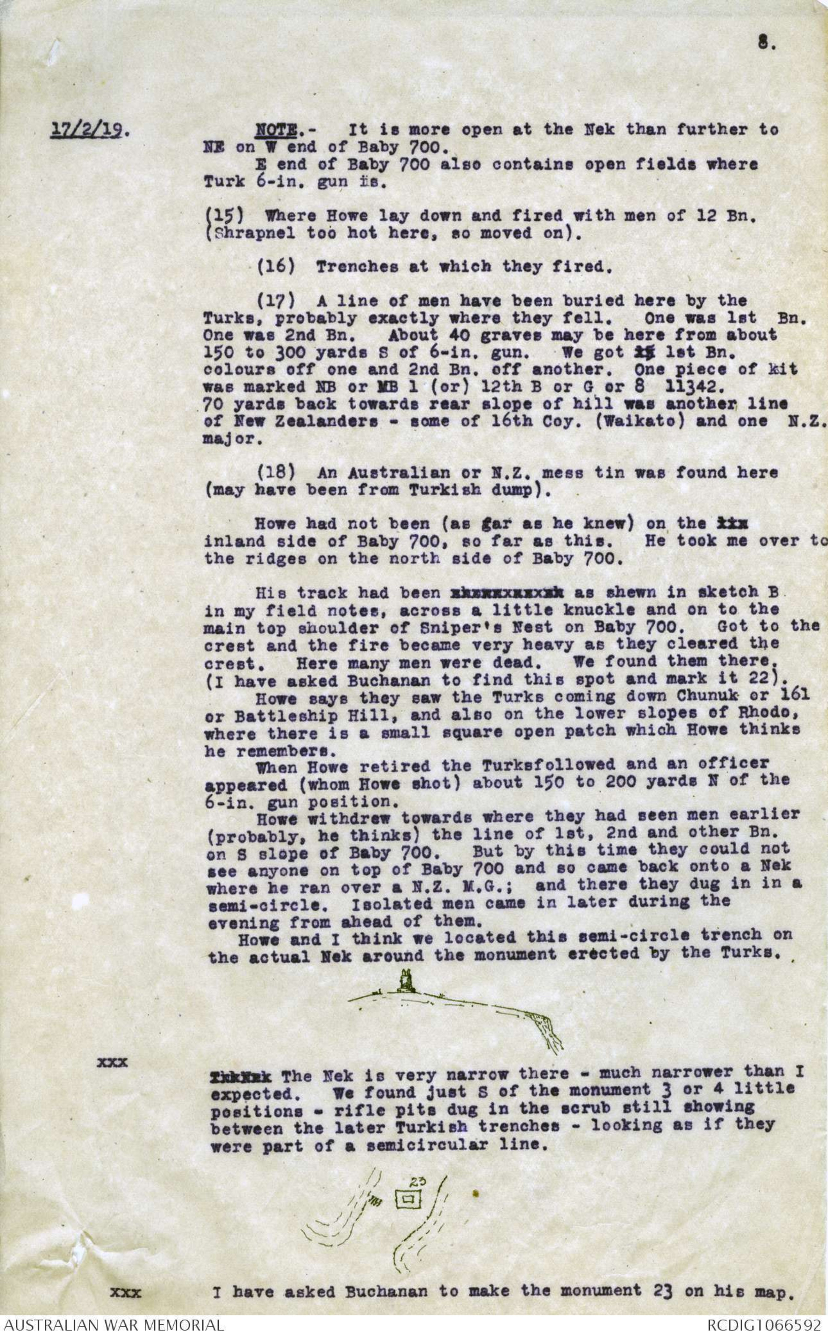
Howe and I think we located this semi-circle trench on
the actual Nek around the monument erected by the Turks.
xxx Diagram- see original document
xxxxxx The Nek is vey narrow there - much narrower than I
expected. We found just S of the monument 3 or 4 little
positions - rifle pits dug in the scrub still showing
between the later Turkish trenches - looking as if they
were part of a semicircular line.
xxx Diagram- see original document
I have asked Buchanan to make the monument 23 on his map.
9.
17/2/19. From there Howe's party followed the track ( a 7-ft.
road still clearly seen) back along Walker's Ridge to the
top if Reserve Gully. The Turks followed them pretty close.
About opposite the base of the sphinx Howe tripped over a
Turkish trench and a little later picked up Col. Clark's
pack.
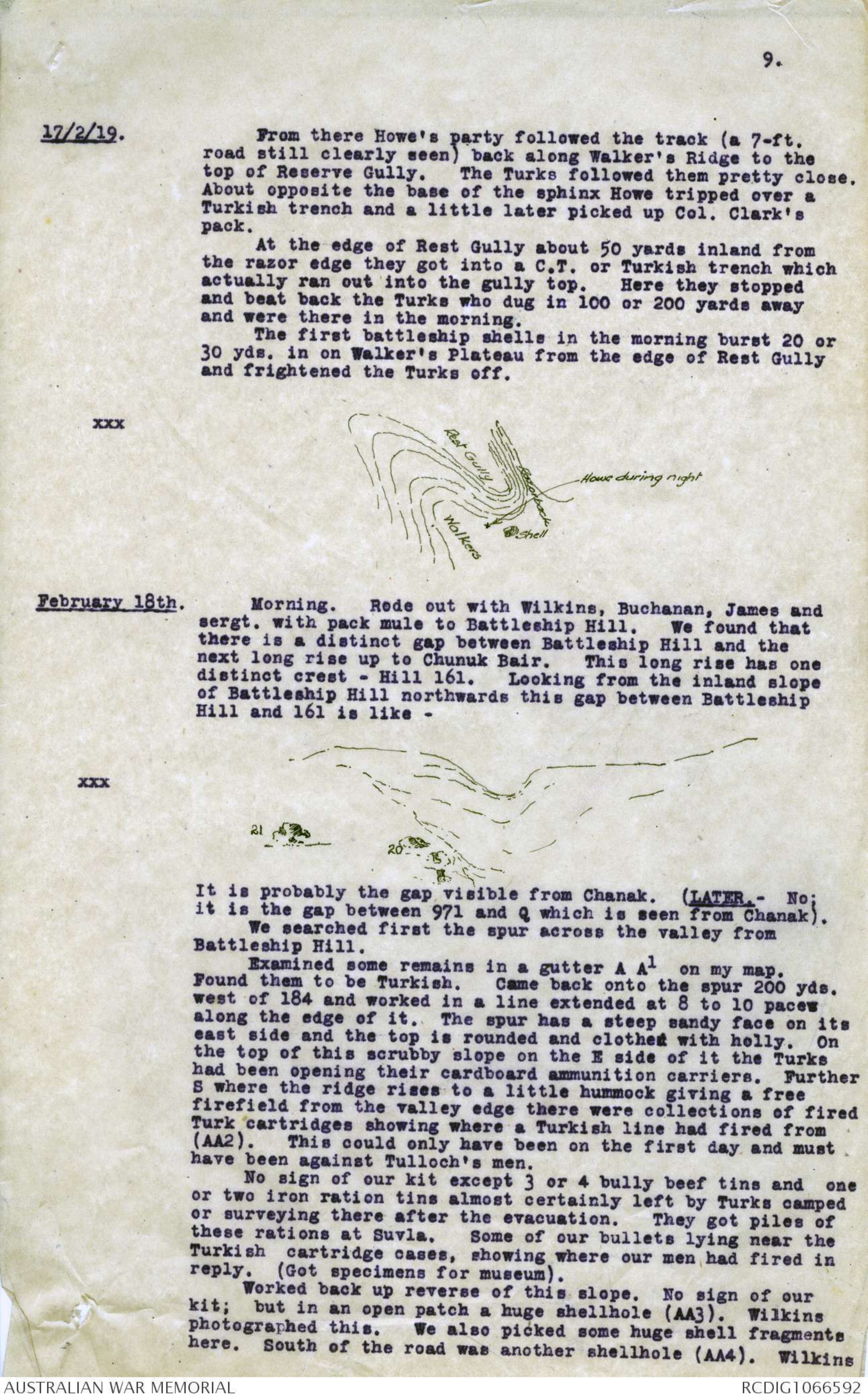
At the edge of Rest Gully about 50 yards inland from
the razor edge they got into a C.T. or Turkish trench which
actually ran out into the gully top. Here they stopped
and beat back the Turks who dug in 100 or 200 yards away
and were there in the morning.
The first battleship shells in the morning burst 20 or
30 yds. in one Walker's Plateau from the edge of Rest Gully
and frightened the Turks off.
xxx Diagram- see original document
February 18th. Morning. Rode out with Wilkins, Buchanan, James and
sergt. with pack mule to Battleship Hill. We found that
there is a distinct gap between Battleship Hill and the
next long rise up to Chunuk Bair. This long rise has one
distinct crest - Hill 161. Looking from the inland slope
of Battleship Hill northwards this gap between Battleship
Hill and 161 is like -
xxx Diagram- see original document
It is probably the gap visible from Chanak. (LATER. - No;
it is the gap between 971 and Q which is seen from Chanak).
We searched first the spur across the valley from Battleship Hill.
Examined some remains in a gutter A A1 on my map.
Found them to be Turkish. Came back onto the spur 200 yds.
west of 184 and worked in a line extended at 8 to 10 paces
along the edge of it. The spur has a steep sandy face on its
east side and the top is rounded and clothed with holly. On
the top of this scrubby slope on the E side of it the Turks
had been opening their cardboard ammunition carriers. Further
S where the ridge rises to a little hummock giving a free
firefield from the valley edge there were collections of fired
Turk cartridges showing where a Turkish line had fired from
(AA2). This could only have been on the first day and must
have been against Tulloch's men.
No sign of our kit except 3 or 4 bully beef tins and one
or two iron ration tins almost certainly left by Turks camped
or surveying there after the evacuation. They got piles of
these rations at Suvla. Some of our bullets lying near the
Turkish cartridges cases, showing where our men had fired in
reply. (Got specimens for museum).
Worked back up reverse of this slope. No sign of our
kit; but in an open patch a huge shellhole (AA3). Wilkins
photographed this. We also picked some huge shell fragments
here. South of the road was another shellhole (AA4). Wilkins
10.
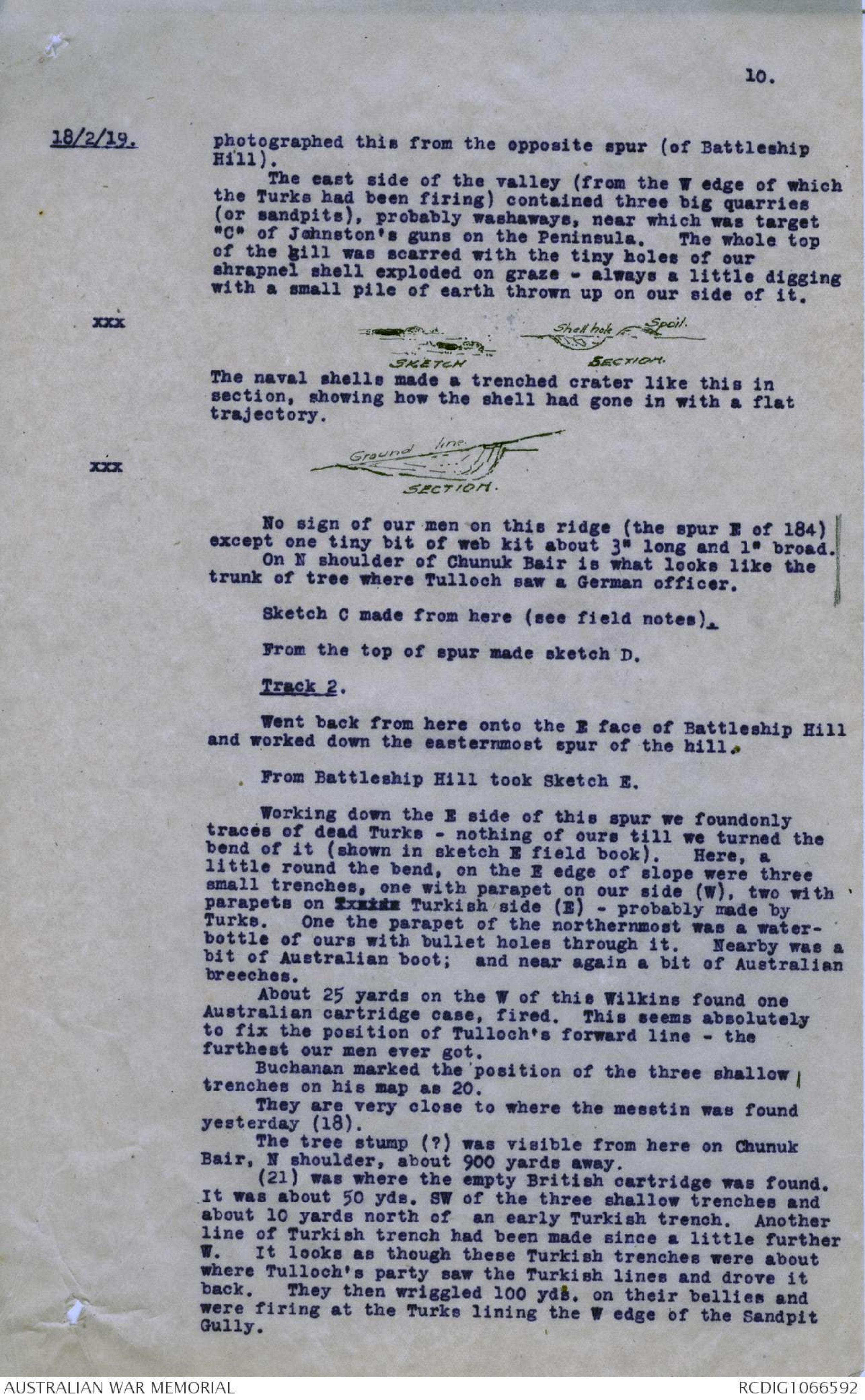
18/2/19. photographed this from the opposite spur (of Battleship
Hill).
The east side of the valley (from the W edge of which
the Turks had been firing) contained three big quarries
(or sandpits), probably washaways, near which was target
"C" of Johnston's guns on the Peninsula. The whole top
of the gill was scarred with the tiny holes of our
shrapnel shell exploded on graze - always a little digging
with a small pile of earth thrown up on our side of it.
xxx Diagram- see original document
The naval shells made a trenched crater like this in
section, showing how the shell had gone in with a flat
trajectory.
xxx Diagram- see original document
No sign of our men on this ridge (the spur E of 184)
except one tiny bit of web kit about 3" long and 1"
broad. On N shoulder of Chunuk Bair is what looks like
the trunk of tree where Tulloch saw a German officer.
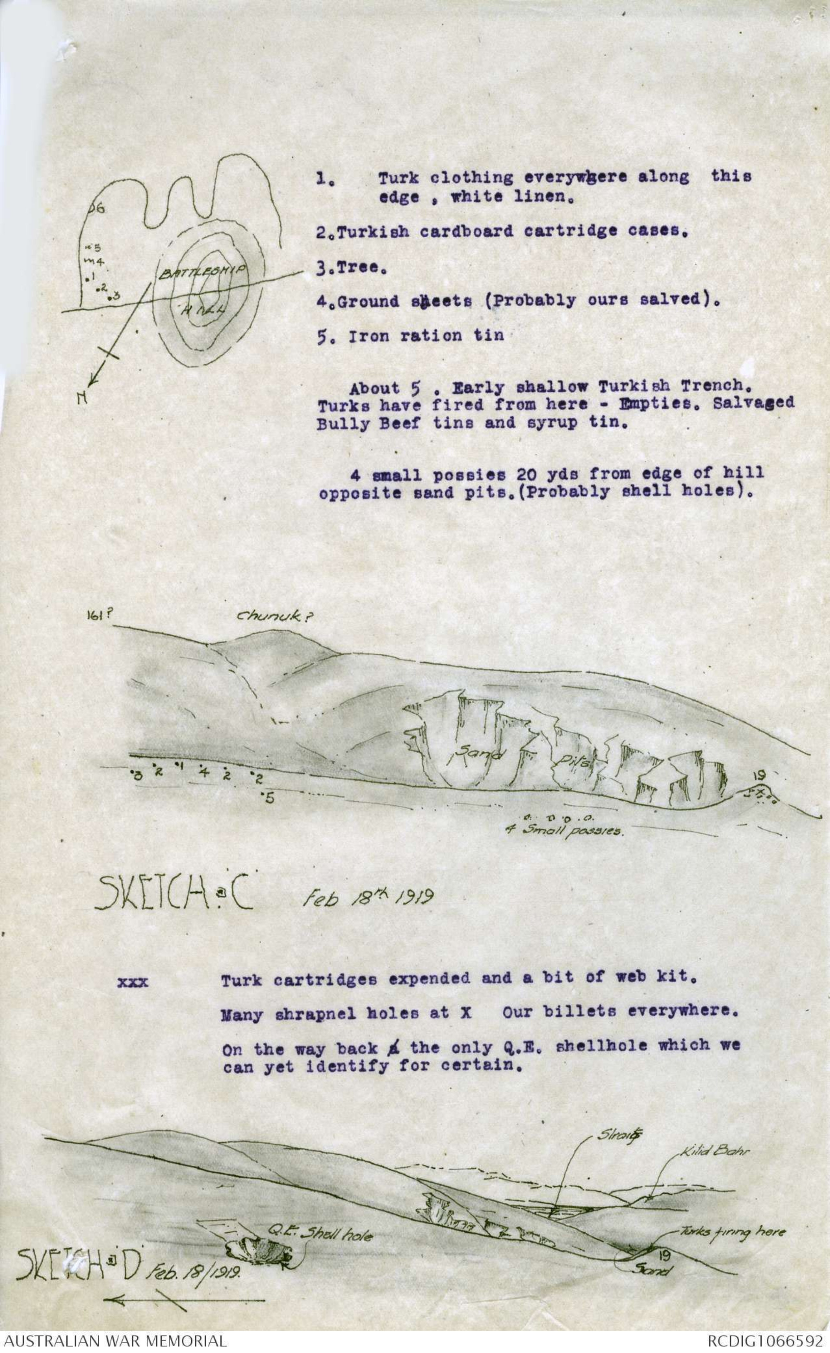
Sketch C made from here (see field notes).
From the top of spur made sketch D.
Track 2.
Went back from here onto the E face of Battleship Hill
and worked down from the easternmost spur of the hill.
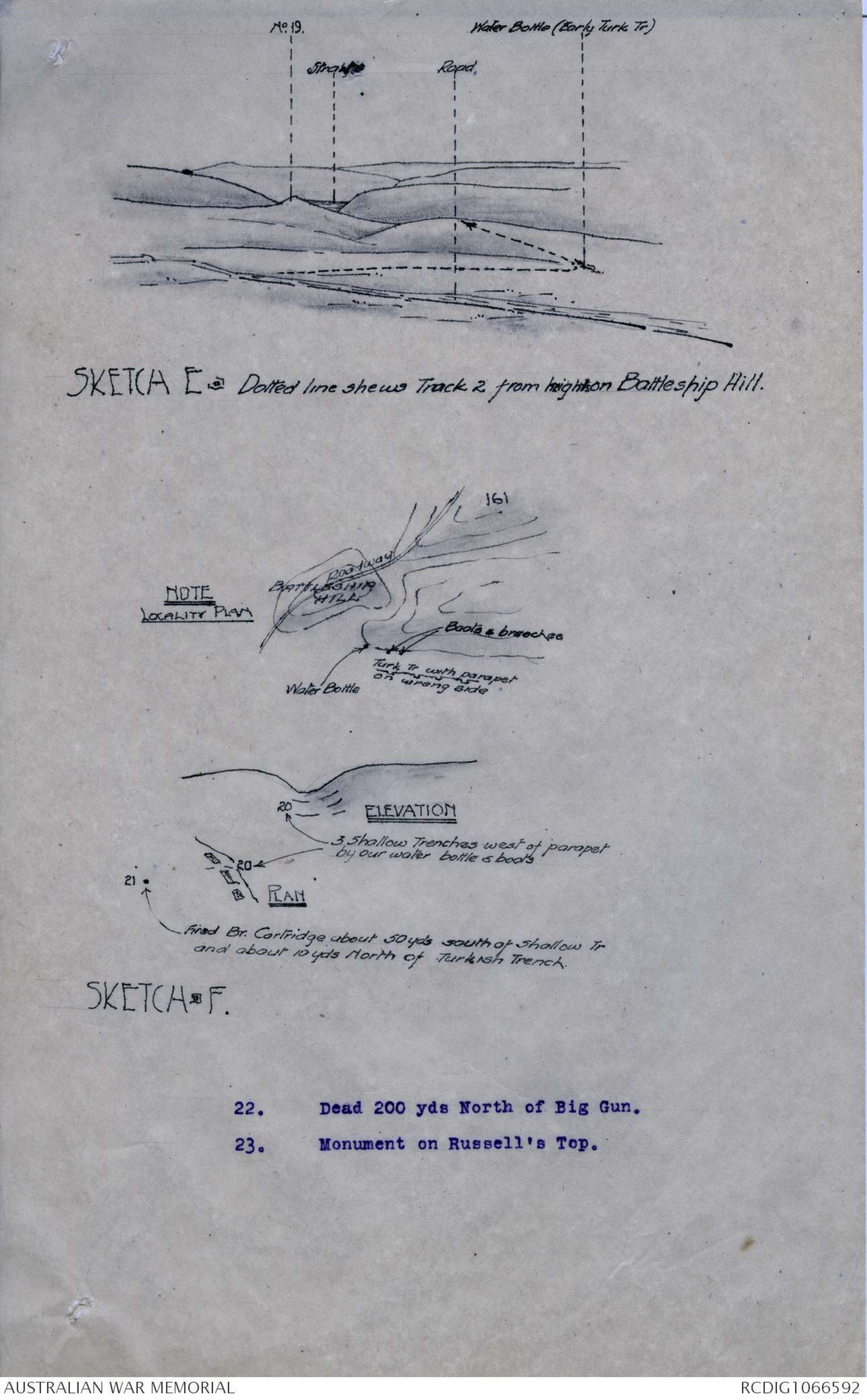
From Battleship Hill took Sketch E.
Working down the E side of this spur we found only
traces of dead Turks - nothing of ours till we turned the
bend of it (shown in sketch E field book). Here, a
little round the bend, on the E edge of slope were three
small trenched, one with parapet on our side (W), two with
parapets of xxxxxx Turkish side (E) - probably made by
Turks. One the parapet of the northernmost was a water-bottle
of ours with bullet holes through it. Nearby was a
bit of Australian boot; and near again a bit of Australian
breeches.
About 25 yards on the W of this Wilkins found one
Australian cartridge case, fired. This seems absolutely
to fix the position of Tulloch's forward line - the
furthest our men ever got.
Buchanan marked the position of the three shallow
trenches on his map as 20.
They are very close to where the mess tin was found
yesterday (18).
The tree stump (?) was visible from here on Chunuk
Bair, N shoulder, about 900 yards away.
(21) was where the empty British cartridge was found.
It was about 50 yds. SW of the three shallow trenches
and about 10 yards north of an early Turkish trench. Another
line of Turkish trench had been made since a little further
W. It looks as though these Turkish trenches were about
where Tulloch's party saw the Turkish lines and drove it
back. They then wriggled 100 yds. on their bellies and
were firing at the Turks lining the W edge of the Sandpit
Gully.
Diagram- see original document
- Turk clothing everywhere along this
edge, white linen.
2. Turkish cardboard cartridge cases.
3. Tree.
4. Ground sheets (Probably ours salved).
5. Iron ration tin
About 5. Early shallow Turkish Trench.
Turks have fired from here - Empties. Salvaged
Bully Beef tins and syrup tin.
4 small possies 20 yds from edge of hill
opposite sand pits. (Probably shell holes).
Diagram- see original document
xxx Turk cartridges expended and a bit of web kit.
Many shrapnel holes at X Our billets everywhere.
On the way back a the only Q.E. shellhole which we
can yet identify for certain.
Diagram- see original document
Diagram- see original document
SKETCH E . Dotted line shews Track 2 from high on Battleship Hill.
Diagram- see original document
11.
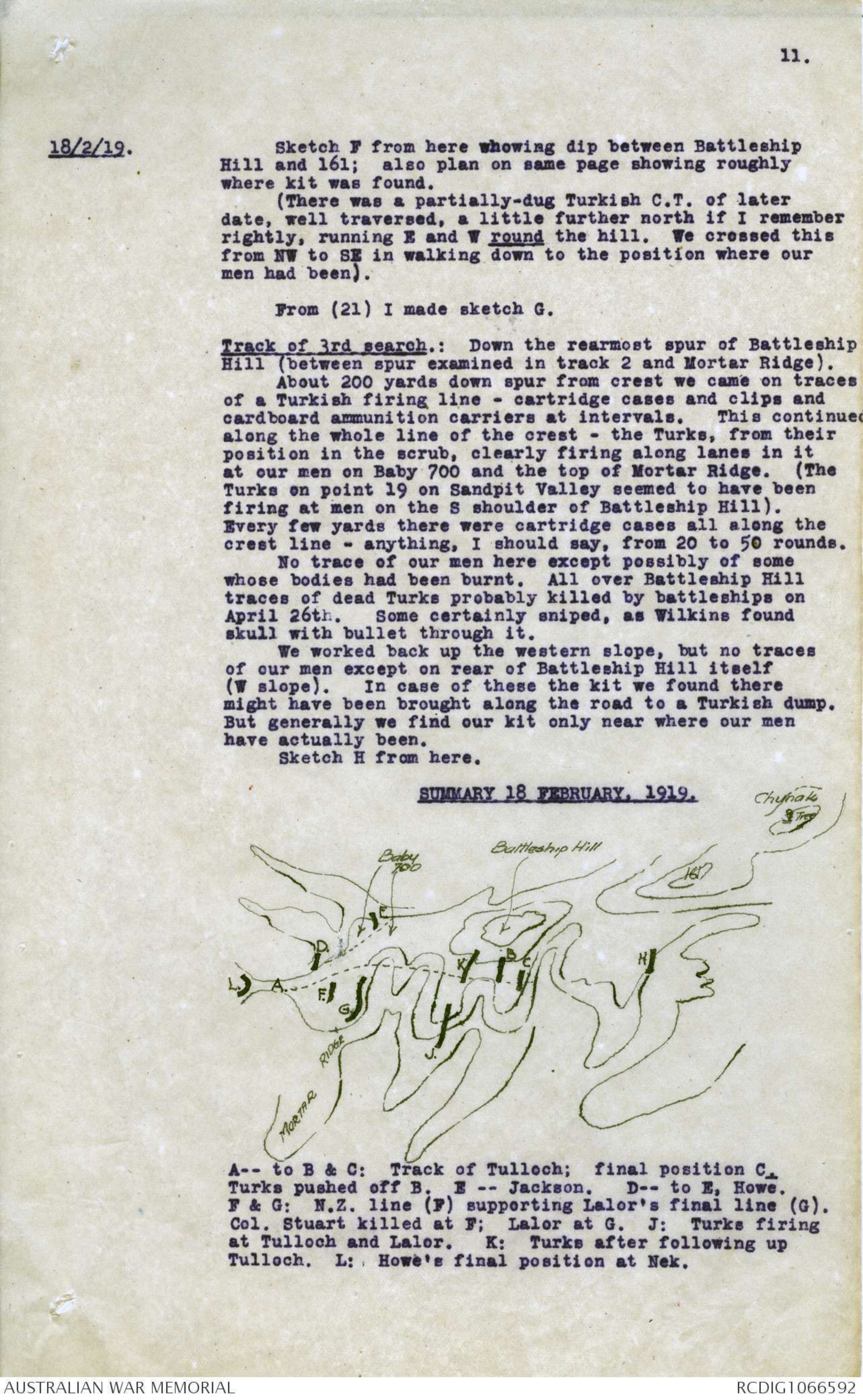
18/2/19. Sketch F from here whowing dip between Battleship
Hill and 161; also plan on same page showing roughly
where kit was found.
(There was a partially-dug Turkish C.T. of later
date, well traversed, a little further north if I remember
rightly, running E and W round the hill. We crossed this
from NW to SE in walking down to the position where our
men had been).
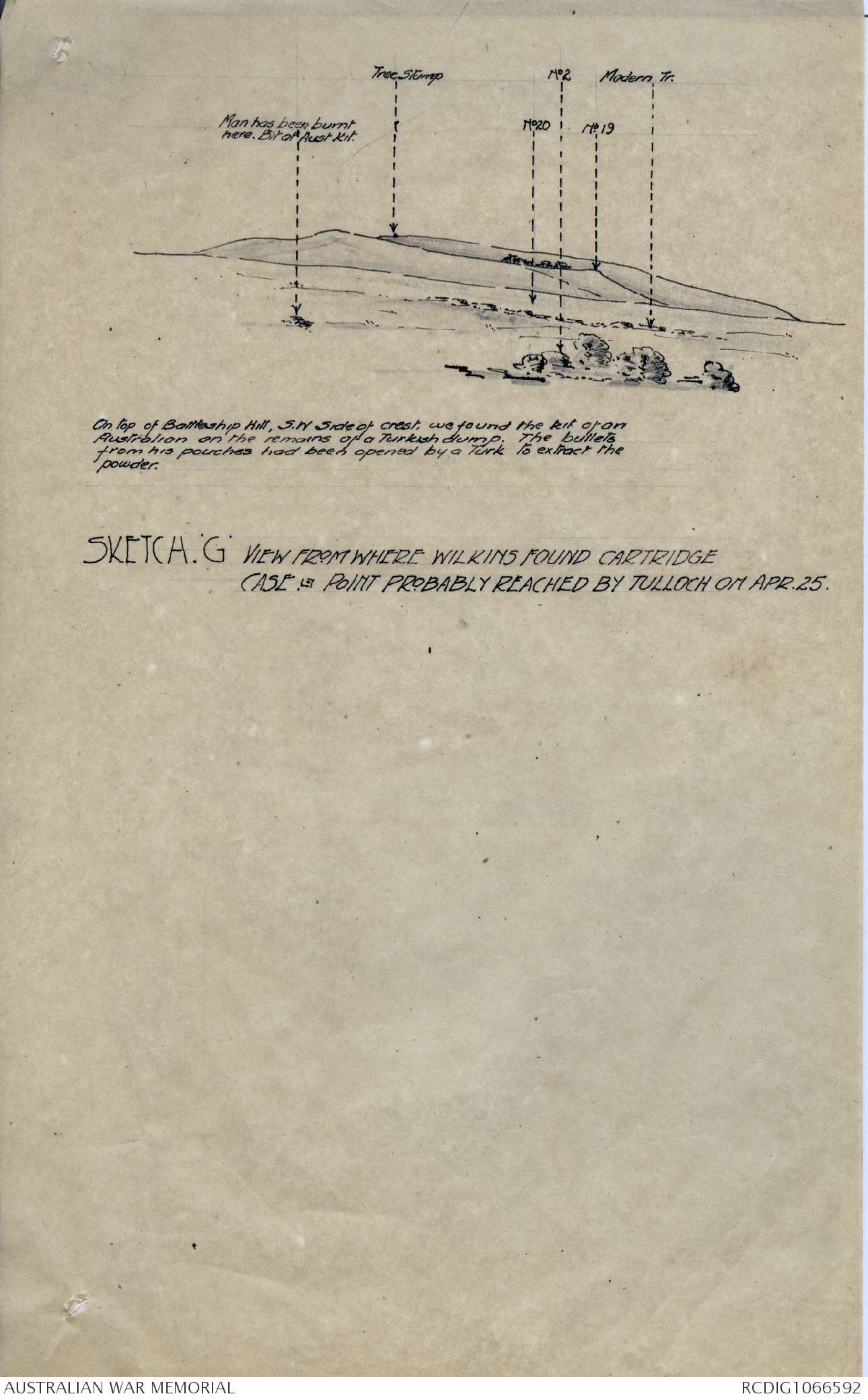
From (21) I made sketch G.
Track of 3rd search.: Down the rearmost spur of Battleship
Hill (between spur examined in track 2 and Mortar Ridge).
About 200 yards down spur from crest we came on traces
of a Turkish firing line - cartridge cases and clips and
cardboard ammunition carriers at intervals. This continued
along the whole line of the crest - the Turks, from their
position in the scrub, clearly firing along lanes in it
at our men on Baby 700 and the top of Mortar Ridge. (The
Turks on point 19 on Sandpit Valley seemed to have been
firing at men on the S shoulder of Battleship Hill).
Every dew yards there were cartridge cases all along the
crest line - anything, I should say, from 20 to 50 rounds.
No traces of our men here except possibly some
whose bodies had been burnt. All over Battleship Hill
traces of dead Turks probably killed by battleships on
April 26th. Some certainly sniped, as Wilkins found
skull with bullet through it.
We worked back up the western slope, but no traces
of our men except on rear of Battleship Hill itself
(W slope). In case of these the kit we found there
might have been brought along the road to a Turkish dump.
But generally we find our kit only near where our men
have actually been.
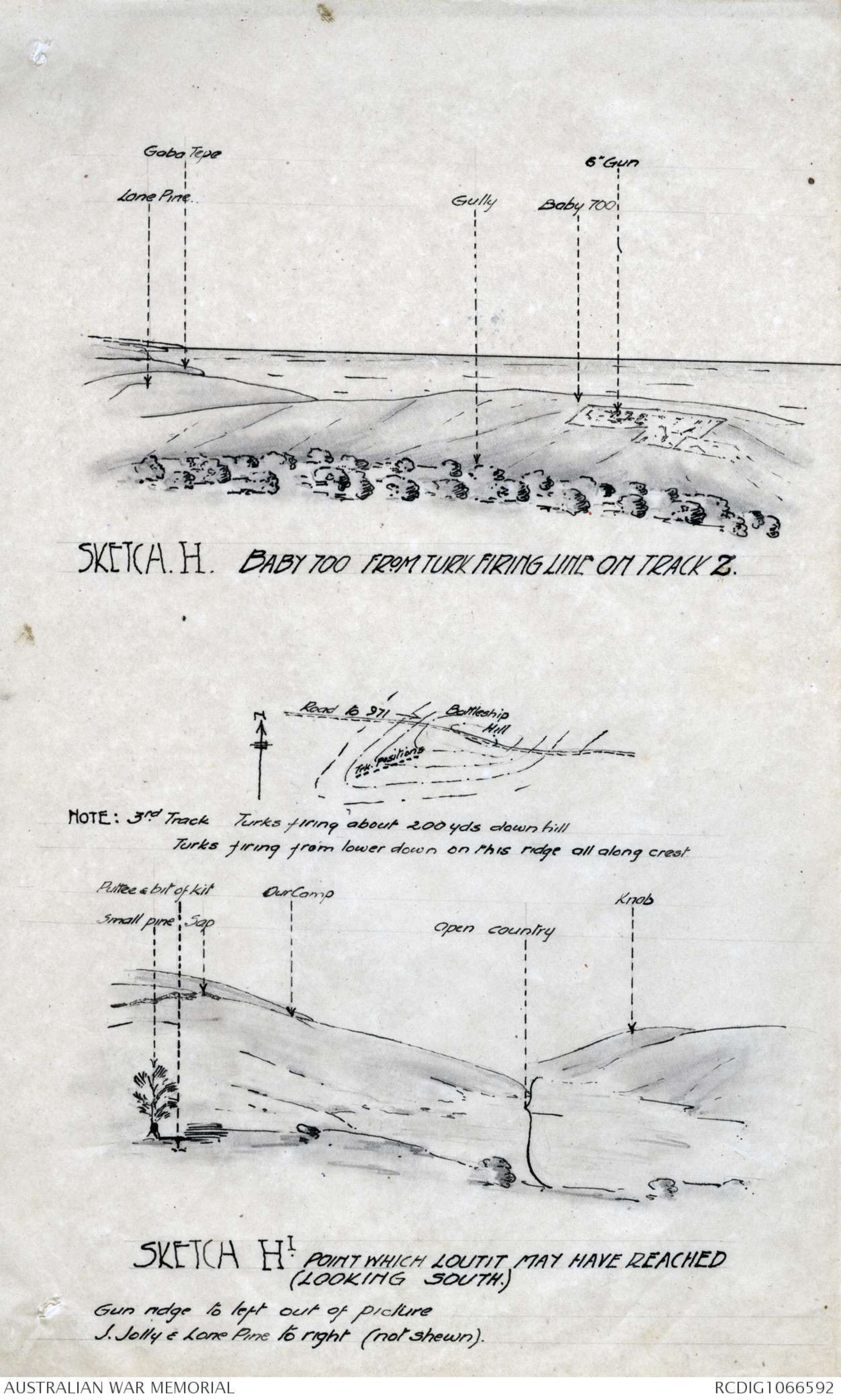
Sketch H from here.
SUMMARY 18 FEBRUARY, 1919
Diagram- see original document
Diagram- see original document
On top of Battleship Hill, S.W Side of crest, we found the kit [[ of an]] Australian on the remains of a Turkish dump. The bullets from his pouches had been opened by a Turk to extract the powder.
SKETCH . G VIEW FROM WHERE WILKINS FOUND CARTRIDGE CASE . POINT PROBABLY REACHED BY TULLOCH ON APR. 25.
Diagram- see original document
SKETCH. H. BABY 700 FROM TURK FIRING LINE ON TRACK Z.
Diagram- see original document
SKETCH HI POINT WHICH LOUTIT MAY HAVE REACHED (LOOKING SOUTH)
 Sam scott
This transcription item is now locked to you for editing. To release the lock either Save your changes or Cancel.
This lock will be automatically released after 60 minutes of inactivity.