Charles E W Bean, Diaries, AWM38 3DRL 606/230/1 - February - March 1919 - Part 3
19
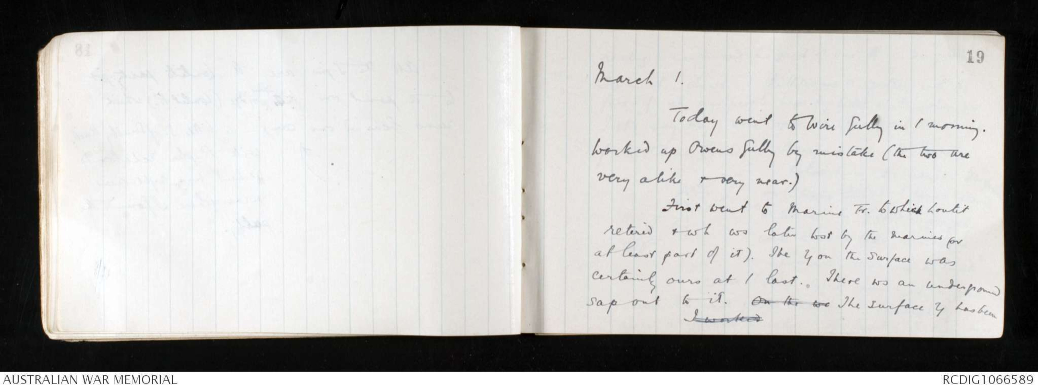
March 1.
Today went to Wire Gully in / morning.
Worked up Owens Gully by mistake (the two are
very alike & very near.)
First went to Marine Tr. to which Loutit
retired & wh ws later lost by the marines for
at least part of it). The trench on the surface was
certainly ours at / last. There ws an underground
sap out to it. On the we The surface trench has beenI worked
20
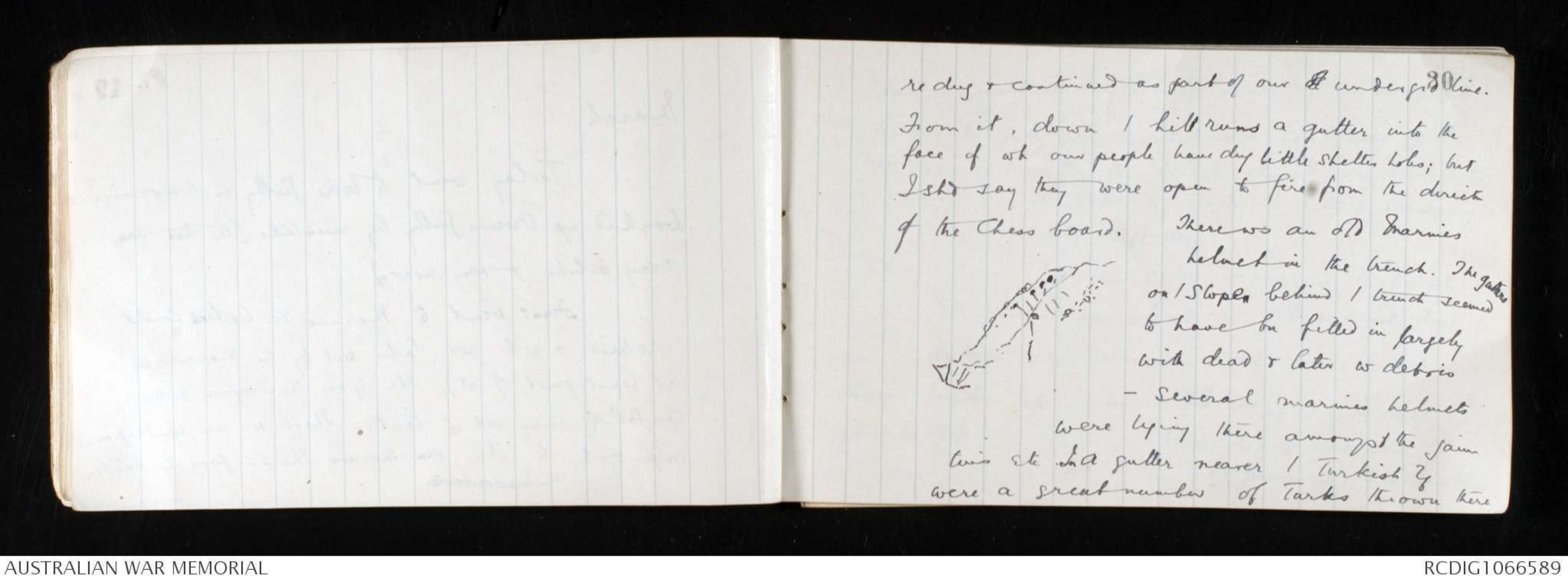
re dug & continued as part of our of undergrd line.
From it, down / hill runs a gutter into the
face of wh our people have dug little shelter holes; but
I shd say they were open to fire from the directn
of the Chess board. There ws an old Marines
Hand drawn diagram - see original
helmet in the trench. The gutters
on / slopes behind / trench seemed
to have bn filled in largely
with dead & later w debris
- several marines helmets
were lying there amongst the jam
tins etc. In a gutter nearer / Turkish trenches
were a great number of Turks thrown there
21
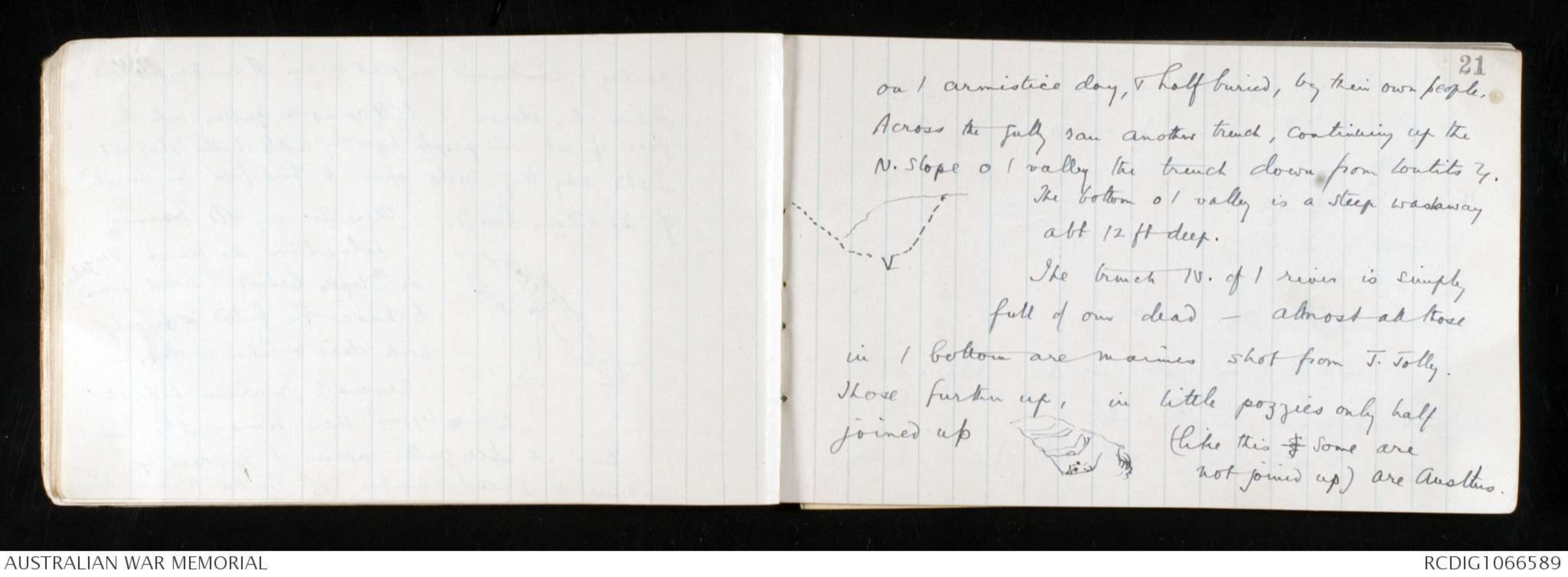
on / armistice day, & half buried, by their own people.
Across the gully ran another trench, continuing up the
N. Slope o / valley the trench down from Loutits trench.
The bottom o / valley is a steep washaway
abt 12 ft deep.
Hand drawn diagram - see original
The trench N. of / river is simply
full of our dead - almost all those
in / bottom are marines shot from J. Jolly.
Those further up, in little pozzies only half
joined up Hand drawn diagram - see original (like this ) Some are
not joined up) are Austlns.
22
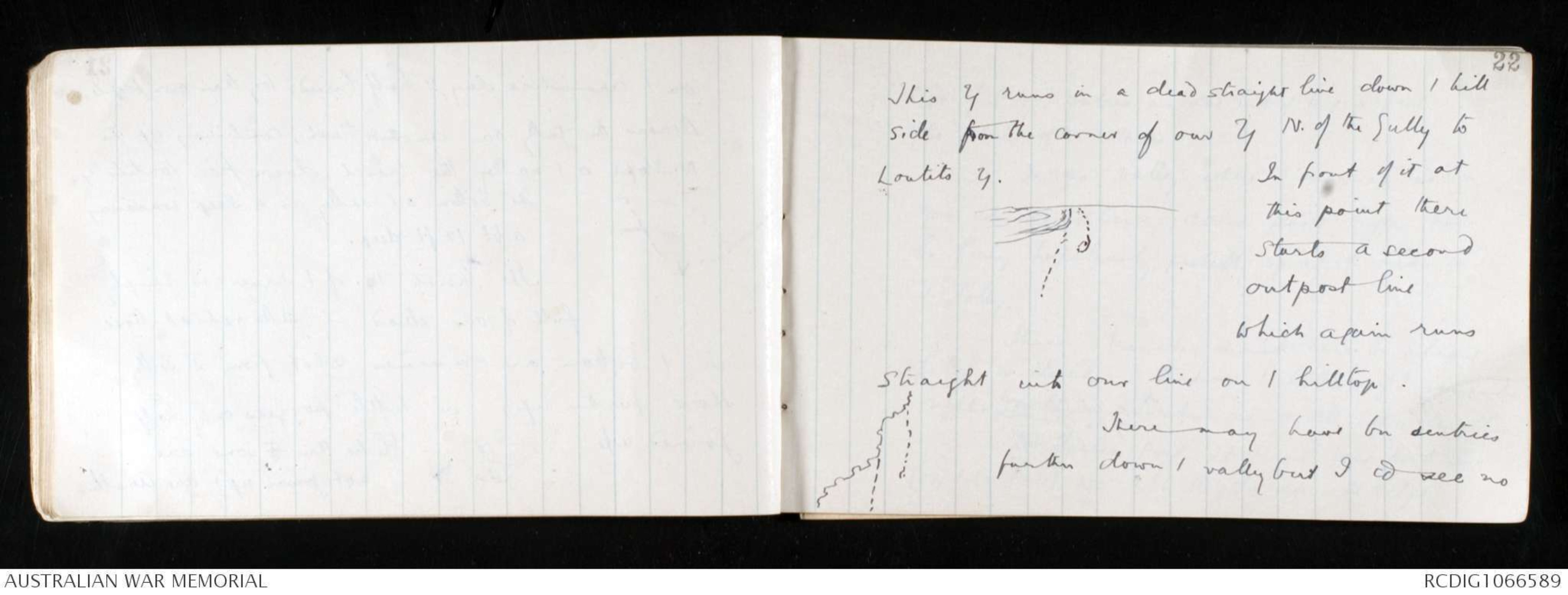
This trench runs in a dead straight line down / hill
side from the corner of our trench N. of the Gully to
Loutits trench.
Hand drawn diagram - see original
In front of it at
this point there
starts a second
outpost line
which again runs
straight into our line on / hilltop.
Hand drawn diagram - see original
There may have bn sentries
further down / valley but I cd see no
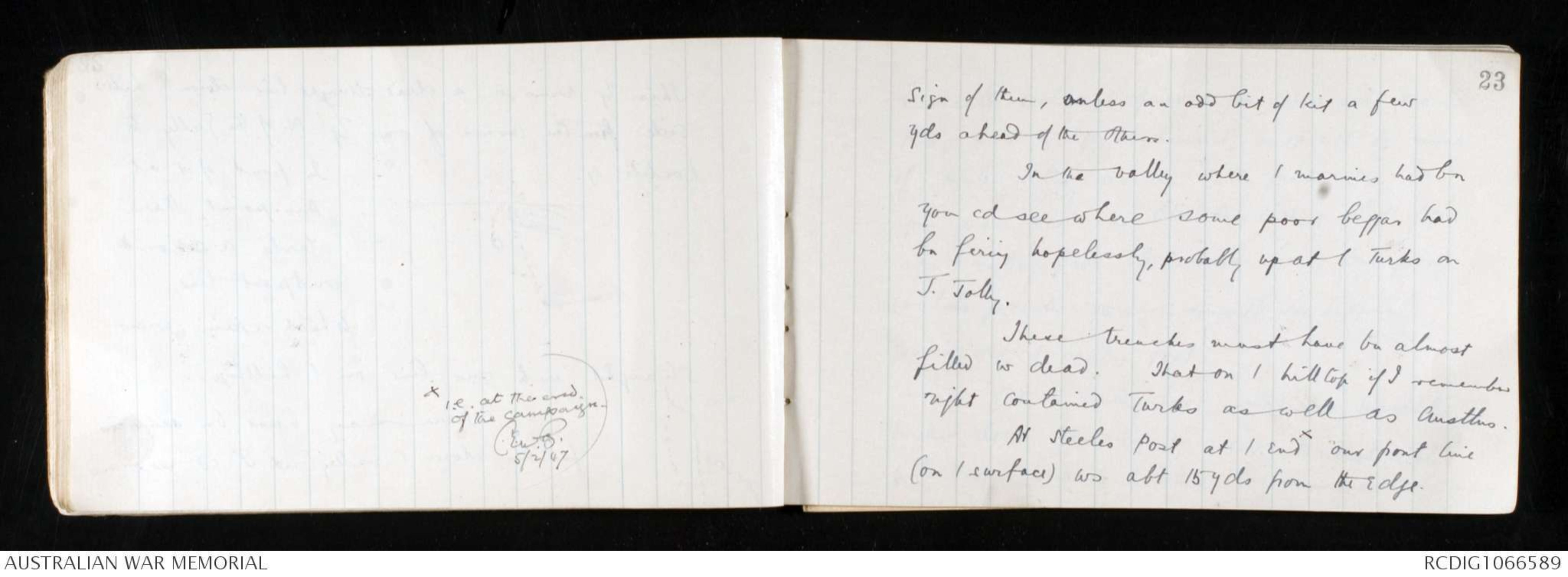
xi.e. at the end
of the campaign.
C.E.W.B. 5/2/47
23
sign of them, unless an odd bit of kit a few
yds ahead of the others.
In the valley where / marines had bn
you cd see where some poor beggar had
bn firing hopelessly, probably up at / Turks on
J. Jolly.
These trenches must have bn almost
filled w dead. That on / hilltop if I remember
right contained Turks as well as Austlns.
At Steeles Post at / endx our front line
(on / surface) ws abt 15 yds from the edge.
24
Everetts Look out gives a good view over Mortar
Ridge & / ridges behind it; but not so much
of Mule valley as the O.Ps. further N.
You can see the Olive trees & a bit of green
at / valley foot from near here; but from
Loutits positn you cannot see / open
ground at / valley foot.
At / valley foot, one (or two) knuckles
further down than our trench are Turkish rifle
pits scooped behind / bottom o / knuckle & some
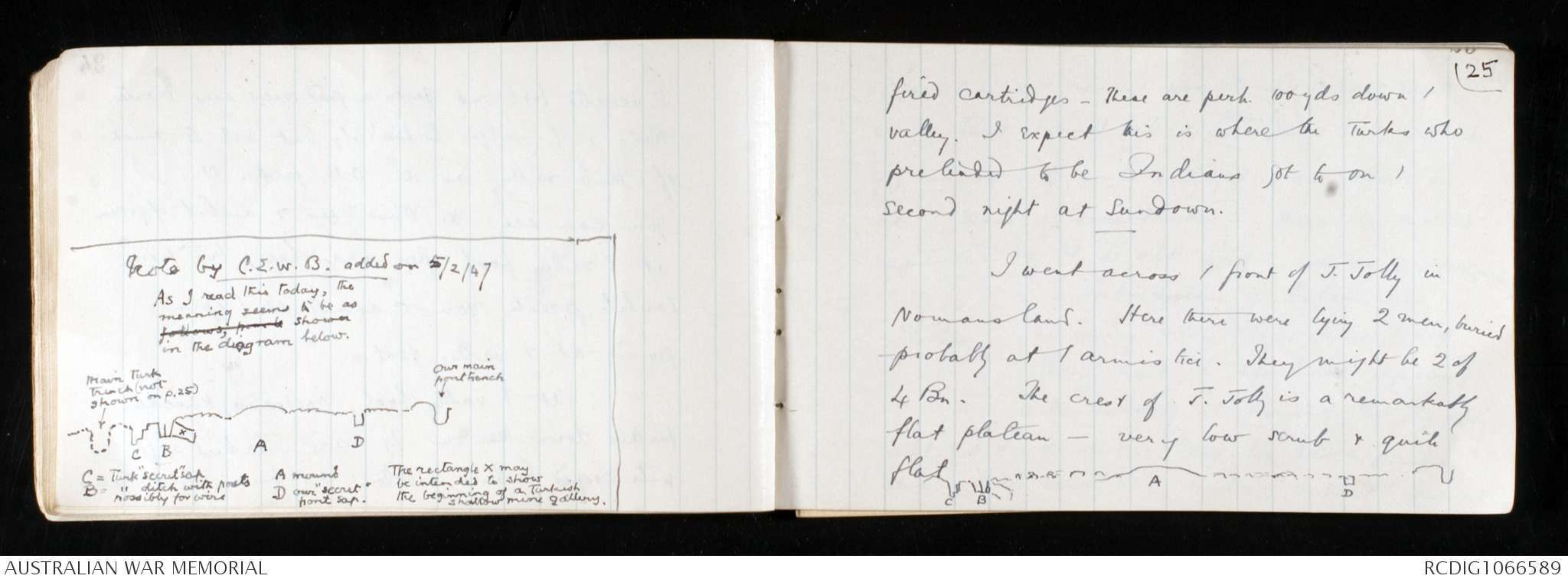
Note by C.E.W.B. added on 5/2/47
As I read this today, the
meaning seems to be asfollows, from t shown
in the diagram below.
Hand drawn diagram - see original
25
fired cartridges - These are perh. 100 yds down /
valley. I expect this is where the Turks who
pretended to be Indians got to on /
second night at Sundown.
I went across / front of J. Jolly in
Nomansland. Here there were lying 2 men, buried
probably at / armistice. They might be 2 of
4 Bn. The crest of J. Jolly is a remarkably
flat plateau - very low scrub & quite
flat
Hand drawn diagram - see original
26
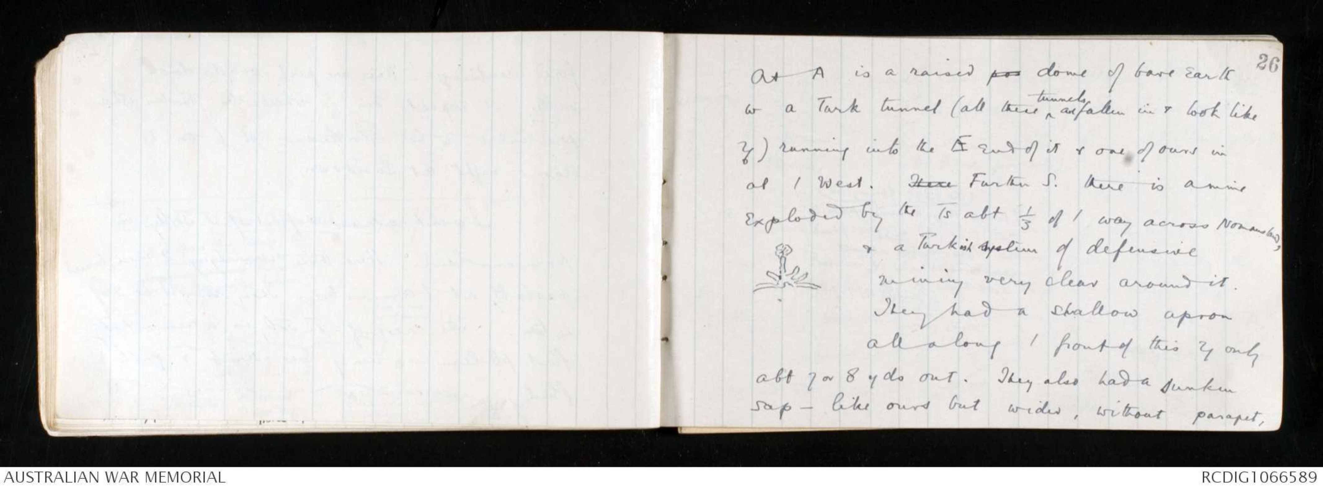
At A is a raised pos dome of bare earth
w a Turk tunnel (all these ^ tunnels are fallen in & look like
trenches) running into the E end of it & one of ours in
at / West. There Further S. there is a mine
exploded by the Ts abt 1/3 of / way across Nomansland,
& a Turkish system of defensive
mining very clear around it.
Hand drawn diagram - see original
They had a shallow apron
all along / front of this trench only
abt 7 or 8 yds out. They also had a sunken
sap - like ours but wider, without parapet,
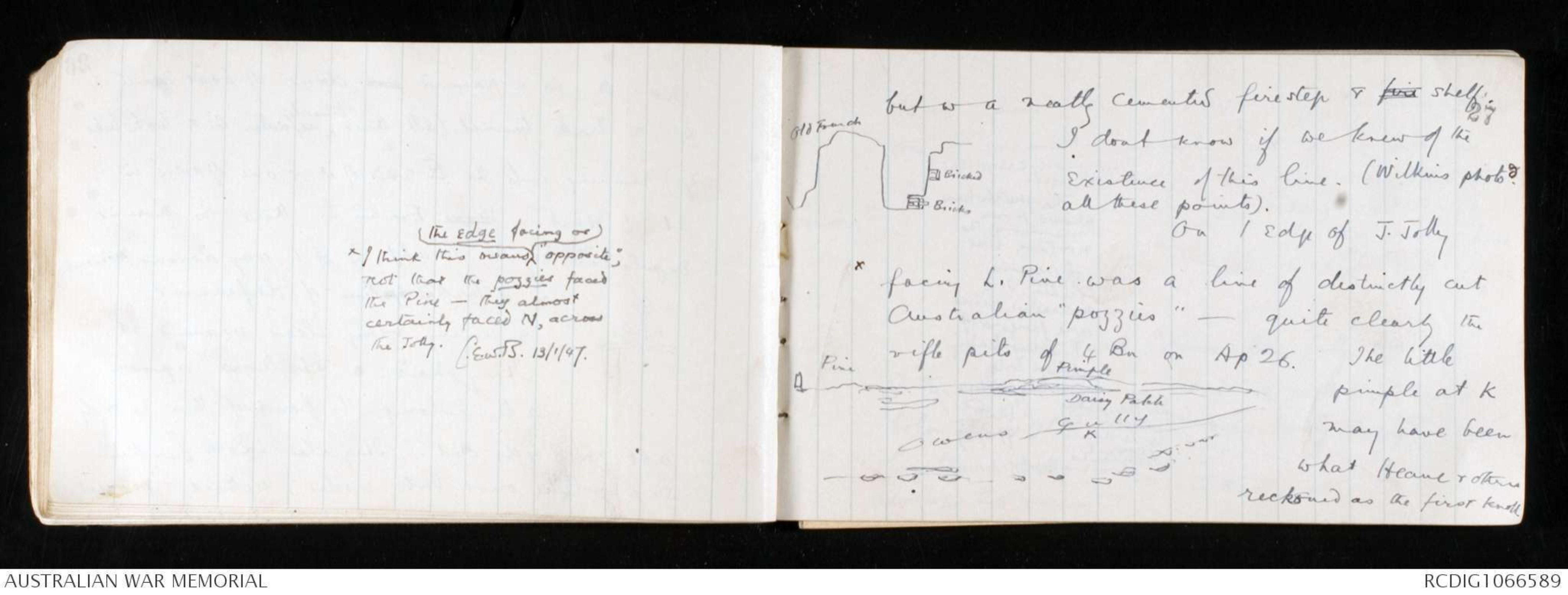
xI think this means ^ the edge facing or "opposite",
not that the pozzies faced
the Pine - they almost
certainly faced N, across
the Jolly.
C.E.W.B. 13/1/47.
27
but w a neatly cemented firestep & fire shelf.
Hand drawn diagram - see original
I dont know if we knew of the
existence of this line. (Wilkins photo [[shorthand]]
all these points).
On / edge of J. Jolly
x facing L. Pine was a line of distinctly cut
Australian "pozzies" - quite clearly the
rifle pits of 4 Bn on Ap 26. The little
pimple at K
may have been
what Heane & others
reckoned as the first knoll.
Hand drawn diagram - see original
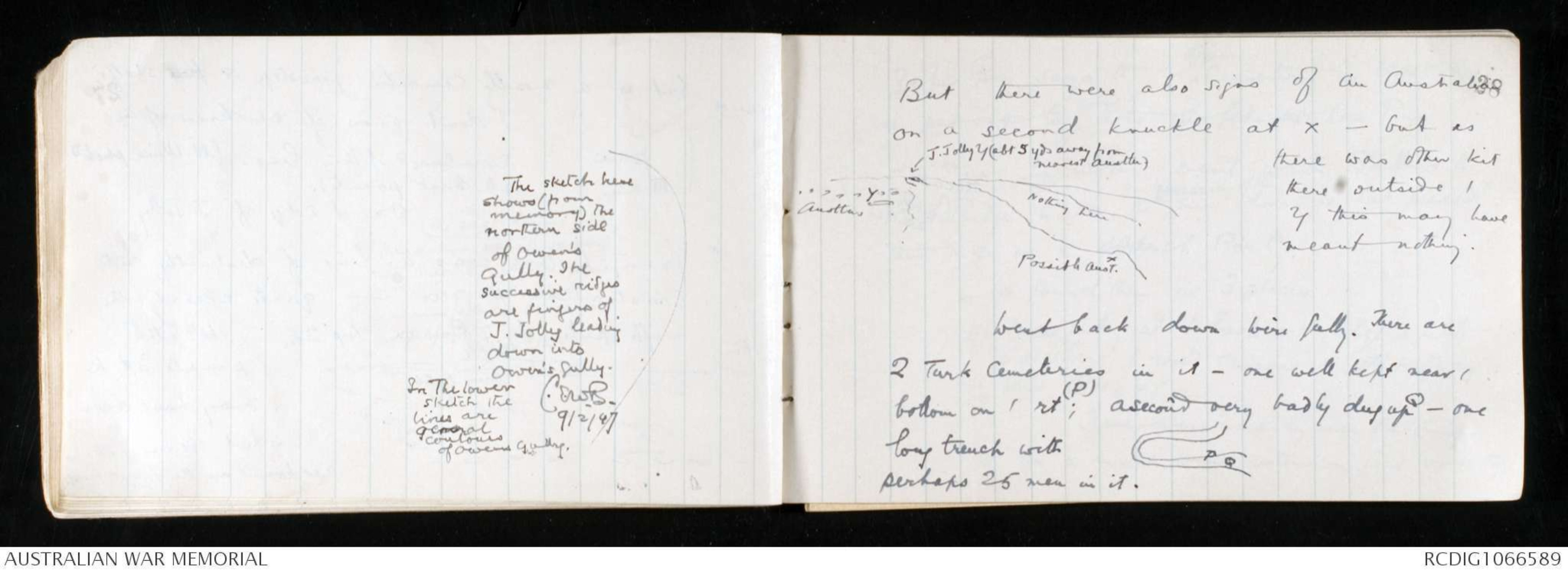
The sketch here
shows (from
memory) the
northern side
of Owen's
Gully. The
successive ridges
are fingers of
J. Jolly leading
down into
Owen's Gully.
In The lower
sketch the
lines are
general
contours
of Owens Gully.
C.E.W.B. 9/2/47
28
But there were also signs of an Australian
on a second knuckle at x - but as
there was other kit
there outside /
trench this may have
meant nothing.
Hand drawn diagram - see original
Went back down Wire Gully. There are
2 Turk Cemeteries in it - one well kept near /
bottom on / rt (P); a second very badly dug up Q - one
long trench with
perhaps 25 men in it.
Hand drawn diagram - see original
 Deb Parkinson
This transcription item is now locked to you for editing. To release the lock either Save your changes or Cancel.
This lock will be automatically released after 60 minutes of inactivity.